Product successfully added to your shopping cart
There are 0 items in your cart. There is 1 item in your cart.
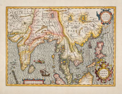
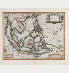
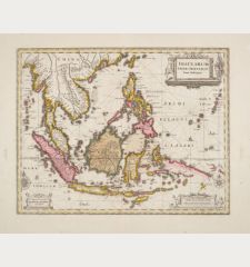
India Orientalis
Jodocus Hondius (*1563 - †1612)Reference 12649
Description
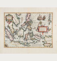
One of the Most Beautiful Early Maps of Southeast Asia.
Antique map of the Indian subcontinent with the Philippines and parts of Indonesia by Jodocus Hondius. Shows Southeast Asia between India and southern part of China up to Taiwan (Formosa). With the Malay Peninsula, Thailand, Vietnam, Cambodia and parts of Sumatra with Borneo. From the French edition of the Mercator-Hondius Atlas of 1623.
Thomas Suárez in Early Mapping of Southeast Asia about this map:
For their artistic character and engraving style, these splendid maps better represent the concluding chapter of the sixteenth century rather than the dawn of the seventeenth. Geographically, Hondius largely followed the Bartolomeu Lasso pattern, adopting many of its idiosyncrasies, such as the Enseada de Cochinchina (Bay of Cochinchina = Gulf of Tongkin) with an exaggerated rendering of the Red River Delta. Hondius adds, however, a bit from his own notebook.
The river systems of Southeast Asia are still depicted classically by Hondius. The rivers west of the Mekong have its source in Lake Chiamay, a large Himalayan lake. The Mergui Archipelago off the Burmese part of the Malay Peninsula is unusually depicted as an island-studded sea, and the oversized island in the north of the Gulf of Siam, called Sian, on which the Siamese court of Ayuthaya sat.
One of the most beautifully engraved early Dutch maps of this region. With three cartouches, two sailing ships and a sea monster.
Details
| Cartographer | Jodocus Hondius |
| Title | India Orientalis |
| Publisher, Year | Henricus Hondius, Amsterdam, 1623 |
| Plate Size | 35.5 x 48.8 cm (14.0 x 19.2 inches) |
| Sheet Size | 45.4 x 55.5 cm (17.9 x 21.9 inches) |
| Reference | Van der Krogt, P.: Koeman's Atlantes Neerlandici, 8400:1A; Suarez, T.: Early Mapping of Southeast Asia, p. 194, Fig. 111. |
Condition
Cartographer
Images to Download
If you like to download the image of this map with a resolution of 1200 pixels, please follow the link below.
You can use this image for publication on your personal or commercial websites for free if you set a link to this website. If you need photographs with a higher resolution, please contact us.


![[Maidegascar, Zanzibar, Scorsia, Inebila, Imangla, Scilam, Dondina] [Maidegascar, Zanzibar, Scorsia, Inebila, Imangla, Scilam, Dondina]](https://www.vintage-maps.com/2957-home_default/bordone-east-africa-madagascar-sri-lanka-1528-1565.jpg)
![[Java Minore] [Java Minore]](https://www.vintage-maps.com/2959-home_default/bordone-southeast-asia-indonesia-sumatra-thailand-borneo.jpg)
