Product successfully added to your shopping cart
There are 0 items in your cart. There is 1 item in your cart.
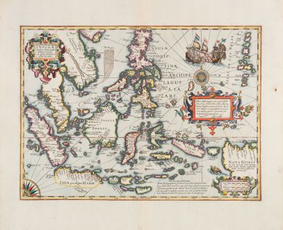
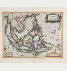
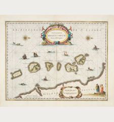
Insulae Indiae Orientalis Praecipuae, In quibus Moluccae celeberrime sunt
Jodocus Hondius (*1563 - †1612)Reference 12777
Description
The Most Elegant and Decorative Map of the Region (Thomas Suarez)
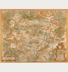
This map by the Dutch mapmaker Jodocus Hondius depicts the European knowledge of the East Indies, which became increasingly important to Europe from the early 16th century onward. It specifically focuses on the valuable Spice Islands, an area that was not well understood at the time. This map was one of the most detailed representations of the East Indies during that period and was notable for being one of the few regional maps to mention Francis Drake's landings in the area.
The map covers the region from the Philippines to Timor and from Sumatra to New Guinea. The title cartouche in the upper right corner includes a portion of China. A compass rose is situated in the lower left corner, connected to another compass rose in the eastern portion of the map by rhumb lines. In the upper right corner, there is a vivid depiction of a battle between two European ships, illustrating the intense competition for control in this region during the early modern period. The map marks the sandbanks and shoals surrounding the islands, as well as major settlements on the islands. A scale in the lower right corner partially obscures the coast of New Guinea, while a decorative text box in the sea east of the Philippines highlights the abundance of spices available in the Moluccas Islands, such as cinnamon, nutmeg, cloves, and ginger.
The map also references other explorers. Of particular significance is the comment "Huc Franciscus Dra. Appulit," which appears near the unknown southern coast of Java, indicating Drake's landing during his circumnavigation from 1577 to 1580. Hondius, the mapmaker, had firsthand knowledge of Drake's voyage, as he was a religious refugee in London from 1583 to 1592 and acquainted with the navigator.
Details
| Cartographer | Jodocus Hondius |
| Title | Insulae Indiae Orientalis Praecipuae, In quibus Moluccae celeberrime sunt |
| Publisher, Year | Henricus Hondius, Amsterdam, 1633 |
| Plate Size | 34.3 x 47.3 cm (13.5 x 18.6 inches) |
| Sheet Size | 47.9 x 56.7 cm (18.9 x 22.3 inches) |
| Reference | Van der Krogt, P.: Koeman's Atlantes Neerlandici, 8500:1A; Suarez, T.: Early Mapping of Southeast Asia, p. 193, Fig. 112. |
Condition
Cartographer
Images to Download
If you like to download the image of this map with a resolution of 1200 pixels, please follow the link below.
You can use this image for publication on your personal or commercial websites for free if you set a link to this website. If you need photographs with a higher resolution, please contact us.
Southeast Asia - Hondius, Jodocus - Insulae Indiae Orientalis Praecipuae, In...

![[Maidegascar, Zanzibar, Scorsia, Inebila, Imangla, Scilam, Dondina] [Maidegascar, Zanzibar, Scorsia, Inebila, Imangla, Scilam, Dondina]](https://www.vintage-maps.com/2957-home_default/bordone-east-africa-madagascar-sri-lanka-1528-1565.jpg)
![[Java Minore] [Java Minore]](https://www.vintage-maps.com/2959-home_default/bordone-southeast-asia-indonesia-sumatra-thailand-borneo.jpg)
