Product successfully added to your shopping cart
There are 0 items in your cart. There is 1 item in your cart.
Total products
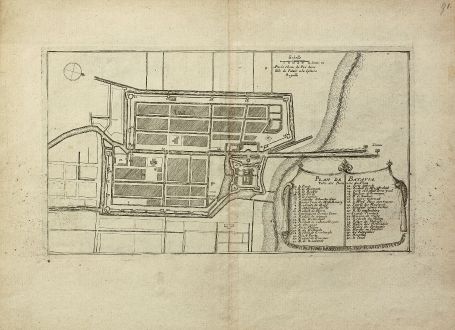
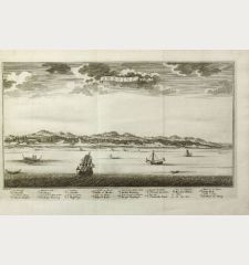
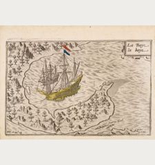
Plan de Batavia
Nicolas de Fer (*1646 - †1720)Antique map of Batavia, Jakarta, Java, Indonesia. Printed in Paris by Fer, N. in 1696.
Reference 11266
Description
Plan of Jakarta former Batavia the Dutch colonial capital in Indonesia by Nicolas de Fer. The title and key cartouche identifies 41 locations. From Les Forces de l'Europe.
Details
| Cartographer | Nicolas de Fer |
| Title | Plan de Batavia |
| Publisher, Year | Fer, N., Paris, 1696 |
| Plate Size | 16.3 x 29.8 cm (6.4 x 11.7 inches) |
| Sheet Size | 23.2 x 31.3 cm (9.1 x 12.3 inches) |
| Reference | Pollak p. 40 |
Condition
Mainly in right margin some ink spots from printing. Excellent condition.
Cartographer
Nicolas de Fer was born in 1646 and was an important French geographer and cartographer of the late 17th Century. He issued more than 600 separate maps and was appointed Geographer of the King. He died in 1720.
Images to Download
If you like to download the image of this map with a resolution of 1200 pixels, please follow the link below.
You can use this image for publication on your personal or commercial websites for free if you set a link to this website. If you need photographs with a higher resolution, please contact us.
Nicolas de Fer: Plan de Batavia.
Antique map of Batavia, Jakarta, Java, Indonesia. Printed in Paris by Fer, N. in 1696.

![[Maidegascar, Zanzibar, Scorsia, Inebila, Imangla, Scilam, Dondina] [Maidegascar, Zanzibar, Scorsia, Inebila, Imangla, Scilam, Dondina]](https://www.vintage-maps.com/2957-home_default/bordone-east-africa-madagascar-sri-lanka-1528-1565.jpg)
![[Java Minore] [Java Minore]](https://www.vintage-maps.com/2959-home_default/bordone-southeast-asia-indonesia-sumatra-thailand-borneo.jpg)
