Product successfully added to your shopping cart
There are 0 items in your cart. There is 1 item in your cart.
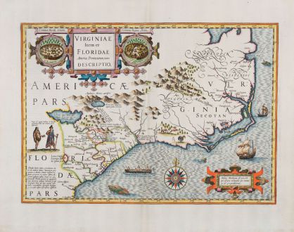
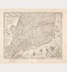
Virginiae Item et Floridae Americae Provinciarum, nova Descriptio
Jodocus Hondius (*1563 - †1612)Reference 12769
Description
One of the great early maps of the North-American South, before the Jamestown colony was established.
The Mercator-Hondius map of Virginia and Florida, originally published in 1606 by Jodocus Hondius, stands as an important early map of the American South predating the Jamestown colony. It holds significance as the sole regional American map featured in Hondius' edition of the Mercator Atlas. The map provides a remarkably accurate depiction of the coastline stretching from St. Augustine to the Chesapeake Bay, along with inland regions. Hondius pieced together information from John White's map of Virginia (which later became North Carolina), Le Moyne-De Bry's map of Florida (encompassing South Carolina, Georgia, and northern Florida), as well as early travel accounts to create a map of considerable interest.
Along the coast, the map presents a relatively precise northeastward shoreline extending from the Spanish fort of St. Augustine to the St. John's River (referred to as R. de May), where the second unsuccessful Huguenot colony struggled in 1564. The coastline continues northward to Port Royal, where the first unsuccessful Huguenot colony faltered in 1562, and further to Cape Fear (identified as Cape St. Romano), the Outer Banks, and ultimately the yet unexplored Chesapeake Bay. Concerning the interior regions, the map incorporates a mix of rumors and imaginative elements, with the "Apalatcy" mountain range serving as the alleged source of many rivers, as well as being associated with potential gold and silver deposits. Notably, the South Carolina-Georgia portion of the interior bears numerous annotations indicating native villages, although the veracity of these claims is difficult to ascertain at this stage. The map includes visual embellishments borrowed from Le Moyne and White, such as illustrations depicting native towns, a native king and queen, and a canoe. The title cartouche features an aesthetically pleasing tripartite design with the two village illustrations flanking the title.
Details
| Cartographer | Jodocus Hondius |
| Title | Virginiae Item et Floridae Americae Provinciarum, nova Descriptio |
| Publisher, Year | Henricus Hondius, Amsterdam, 1628 |
| Plate Size | 34.2 x 48.1 cm (13.5 x 18.9 inches) |
| Sheet Size | 47.7 x 56.7 cm (18.8 x 22.3 inches) |
| Reference | Van der Krogt, P.: Koeman's Atlantes Neerlandici, 9400:1A; Burden, P.D.: The Mapping of North America No. 151 |
Condition
Cartographer
Images to Download
If you like to download the image of this map with a resolution of 1200 pixels, please follow the link below.
You can use this image for publication on your personal or commercial websites for free if you set a link to this website. If you need photographs with a higher resolution, please contact us.
North America - Hondius, Jodocus - Virginiae Item et Floridae Americae...

