Product successfully added to your shopping cart
There are 0 items in your cart. There is 1 item in your cart.
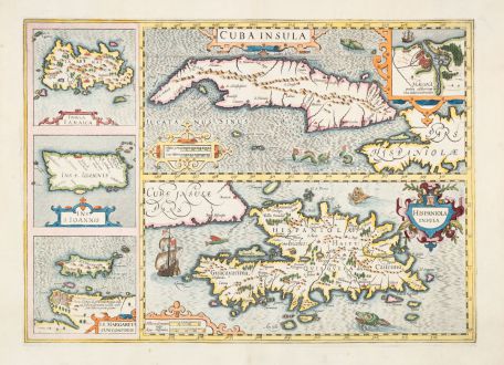
Cuba Insula / Hispaniola Insula / Insula Iamaica / Ins. S. Ioannis / I.S. Margareta cum...
Jodocus Hondius (*1563 - †1612)Reference 12882
Description
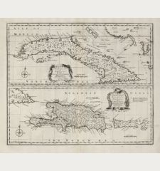
This beautiful antique map by Jodocus Hondius showcases Cuba and Hispaniola, with insets featuring Jamaica, Puerto Rico, and Margarita Island. It's a beautifully engraved map, rich in detail, adorned with sea monsters and ships, making it highly desirable.
Cuba is prominently displayed, encompassing the Cayman Islands, Isla de Pinas, and a portion of Hispaniola. A detailed inset of the port of Havana and its surroundings is included. The sea areas are intricately engraved, featuring various sea monsters. The Hispaniola map, although positioned below Cuba, boasts better detailing, complete with a sailing ship and three sea monsters. One of the sea monsters looks more like a lion or a giant Yorkshire terrier swimming in the sea. Jamaica, Puerto Rico (Ins. S. Ioannis), and the island of Saint Margaret are depicted on the left, with Saint Margaret extending to the nearby Venezuelan coast.
From the French edition of the Mercator-Hondius Atlas of 1633. French text on verso.
Details
| Cartographer | Jodocus Hondius |
| Title | Cuba Insula / Hispaniola Insula / Insula Iamaica / Ins. S. Ioannis / I.S. Margareta cum Confiniis |
| Publisher, Year | J. Hondius, Amsterdam, 1633 |
| Plate Size | 35.3 x 49.1 cm (13.9 x 19.3 inches) |
| Sheet Size | 47.9 x 56.2 cm (18.9 x 22.1 inches) |
| Reference | Van der Krogt, P.: Koeman's Atlantes Neerlandici, 9610:1A. |
Condition
Cartographer
Images to Download
If you like to download the image of this map with a resolution of 1200 pixels, please follow the link below.
You can use this image for publication on your personal or commercial websites for free if you set a link to this website. If you need photographs with a higher resolution, please contact us.
Central America - Caribbean - Hondius, Jodocus - Cuba Insula / Hispaniola Insula / Insula...

![[West Indies, Jamaica, Hispaniola and South America] [West Indies, Jamaica, Hispaniola and South America]](https://www.vintage-maps.com/3035-home_default/bordone-central-america-caribbean-jamaica-hispaniola.jpg)
![[Lesser Antilles, West Indies] Guadalupe, Dominica, Matinina [Lesser Antilles, West Indies] Guadalupe, Dominica, Matinina](https://www.vintage-maps.com/3027-home_default/bordone-central-america-caribbean-guadeloupe-martinique.jpg)
