Product successfully added to your shopping cart
There are 0 items in your cart. There is 1 item in your cart.
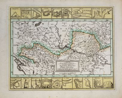
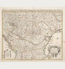
Mappa der zu Carlovitz geschlossenen... Kaiserlich Türkischen Gräntz Scheidung, so in...
Christoph Weigel (*1654 - †1725)Reference 12024
Description
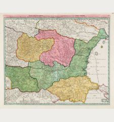
Very rare map with fortifications between the Balkans and Hungary by Christoph Weigel. Shows the results of the Treaty of Karlowitz in 1699, where the border between the Austrian and Ottoman empire was defined. With 19 fortress plans. From Bequemer Schul- und Reisen-Atlas also titled Atlas scholasticus et itinerarius by Christoph Weigel. Weigel's well-known travel atlas, which he published in collaboration with Professor Johann David Köhler.
This map was used as cover illustration for Bordering Early Modern Europe by Maria Baramova, Grigor Boykov and Ivan Parvev, published by Harrassowitz in 2015.
Details
| Cartographer | Christoph Weigel |
| Title | Mappa der zu Carlovitz geschlossenen... Kaiserlich Türkischen Gräntz Scheidung, so in dem Früh Jahr 1699 angefangen... |
| Publisher, Year | Johann Ernst Adelbulner, Nuremberg, 1718 |
| Plate Size | 30.0 x 37.3 cm (11.8 x 14.7 inches) |
| Sheet Size | 35.7 x 44.0 cm (14.1 x 17.3 inches) |
Condition
Cartographer
Images to Download
If you like to download the image of this map with a resolution of 1200 pixels, please follow the link below.
You can use this image for publication on your personal or commercial websites for free if you set a link to this website. If you need photographs with a higher resolution, please contact us.
Balkan - Weigel, Christoph - Mappa der zu Carlovitz geschlossenen......

![[Losinj, Cres, Ossero, Trogir, Svetac, Brac, Ciovo] [Losinj, Cres, Ossero, Trogir, Svetac, Brac, Ciovo]](https://www.vintage-maps.com/2951-home_default/bordone-balkan-croatia-dalmatia-losinj-cres-ossero-krk.jpg)
