Product successfully added to your shopping cart
There are 0 items in your cart. There is 1 item in your cart.
Total products
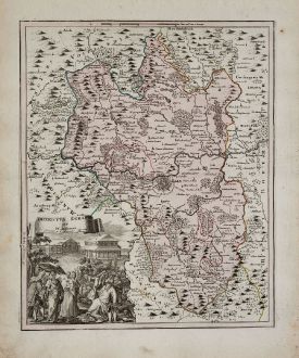
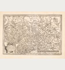
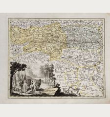
Districtus Egranus per I. C. Mullerum
Christoph Weigel (*1654 - †1725)Old coloured map of Eger Cheb, Chebsko, Egerland. Printed in Nuremberg by Johann Ernst Adelbulner in 1719.
Reference 11986
Description
Rare antique map of Chebsko (Egerland) by Christoph Weigel after Joh. Chr. Müller. Showing the west of the Czech Republic with parts of Upper Franconia. With the river Ohře (Eger), the city of Cheb (Eger) in the centre. Decorated with a beautiful title cartouche.
Details
| Cartographer | Christoph Weigel |
| Title | Districtus Egranus per I. C. Mullerum |
| Publisher, Year | Johann Ernst Adelbulner, Nuremberg, 1719 |
| Plate Size | 38.2 x 31.3 cm (15.0 x 12.3 inches) |
| Sheet Size | 47.0 x 38.2 cm (18.5 x 15.0 inches) |
Condition
Slightly stained in margins. Very good condition.
Cartographer
Christoph Weigel the Elder was an engraver and publisher active in Nuremberg in the early 1700s. During his lifetime he published 70 books and series of engravings, including the atlas Descriptio Orbis Antique in XLIV tabulis published in 1720. For his geographical works and maps, he worked closely together with the highly successful Nuremberg cartographer Johann Baptist Homann. His younger brother, Johann Christoph Weigel (1661-1726) also known as Christoph Weigel the Younger, worked as well as an engraver and publisher in Nuremberg. Weigel's company was continued by his wife when he died in 1725.
Images to Download
If you like to download the image of this map with a resolution of 1200 pixels, please follow the link below.
You can use this image for publication on your personal or commercial websites for free if you set a link to this website. If you need photographs with a higher resolution, please contact us.
Christoph Weigel: Districtus Egranus per I. C. Mullerum.
Old coloured map of Eger Cheb, Chebsko, Egerland. Printed in Nuremberg by Johann Ernst Adelbulner in 1719.
Czechia - Bohemia - Weigel, Christoph - Districtus Egranus per I. C. Mullerum


