Product successfully added to your shopping cart
There are 0 items in your cart. There is 1 item in your cart.
Total products
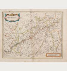
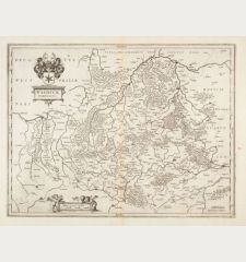
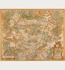
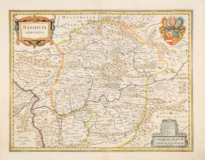
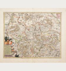
Nassovia Comitatus
Jodocus Hondius (*1563 - †1612)Coloured map of Nassau. Printed in Amsterdam by Henricus Hondius in 1633.
Reference 12888
Description
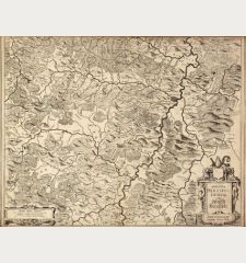
Antique map of the county of Nassau by J. Hondius. Shows the Westerwald and the Taunus with the Lahn river basin (from Lollar to Lahnstein) in the center. With Koblenz, Wiesbaden, Gießen, Olpe, Limburg and Wetzlar. From the Mercator-Hondius Atlas of 1633, French text on verso.
Details
| Cartographer | Jodocus Hondius |
| Title | Nassovia Comitatus |
| Publisher, Year | Henricus Hondius, Amsterdam, 1633 |
| Plate Size | 38.0 x 49.3 cm (15.0 x 19.4 inches) |
| Sheet Size | 48.0 x 57.0 cm (18.9 x 22.4 inches) |
| Reference | Van der Krogt, P.: Koeman's Atlantes Neerlandici, 2390:1.1. |
Condition
Centerfold backed in upper and lower margin. Very good condition.
Cartographer
Jodocus Hondius was born 1563 in Wakken (West Flanders). He became a globe maker and map engraver. In 1593 he set up his business in Amsterdam after he spent several years in London. He was one of the most important engravers of his time and engraved maps for van den Keere, Waghenaer and Speed. Hondius bought the plates of Mercator in 1604, added around 40 maps and published the expanded Mercator-Atlas first 1606 still under Mercator's name. After his death 1612 in Amsterdam, the business was carried out by his sons Jodocus II and Henricus.
Images to Download
If you like to download the image of this map with a resolution of 1200 pixels, please follow the link below.
You can use this image for publication on your personal or commercial websites for free if you set a link to this website. If you need photographs with a higher resolution, please contact us.
Jodocus Hondius: Nassovia Comitatus.
Coloured map of Nassau. Printed in Amsterdam by Henricus Hondius in 1633.
North Rhine-Westphalia - Hondius, Jodocus - Nassovia Comitatus

![Westfalia cum Dioecesi Bremensi [2 Karten] Westfalia cum Dioecesi Bremensi [2 Karten]](https://www.vintage-maps.com/4256-home_default/mercator-germany-lower-saxony-1633.jpg)
![[Kleve, Duisburg, Emmerich, Gennep] Cliviam, Ducatus Clivensis - Duisburgum - Embrica, Clivensis ditionis - Gennapium... [Kleve, Duisburg, Emmerich, Gennep] Cliviam, Ducatus Clivensis - Duisburgum - Embrica, Clivensis ditionis - Gennapium...](https://www.vintage-maps.com/3818-home_default/braun-hogenberg-north-rhine-westphalia-emmerich-duisburg-kleve.jpg)
