Product successfully added to your shopping cart
There are 0 items in your cart. There is 1 item in your cart.
Descriptio Agri Civitatis Coloniensis Cum Suis Limitibus... Beschreibung und abris des...
Braun & HogenbergReference 12784
Description
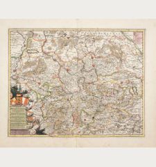
Extremely rare map of Greater Cologne printed from 4 plates.
This extremely rare map by Abraham Hogenberg, printed from 4 copper plates, is one of the rarest sheets in the field of Cologne graphics (Werner Schäfke). The map shows the greater Cologne area stretching between Brühl and Wesseling in the west, Worringen in the east, Bergheim-Fliesteden, Brauweiler and Hürth in the north and Deutz, Porz, Zündorf, Langel and Mülheim in the south. The localities are created in small views, decorated with four cartouches, two coats of arms, a compass rose and a mileage indicator.
Cologne was already well mapped in the Middle Ages with the city views of Anton Woensam from 1531 and Arnold Mercator from 1570. However, these focused exclusively on the inner-city areas. Therefore, the "Schweidkarten", which covered the surrounding countryside, were a valuable addition. In 1590, the Cologne City Council commissioned the creation of a map of the Bannmeile and Burgbann, which also depicted the surrounding villages and farms with the corresponding boundary markings. At this time, these maps of the surroundings were called "Sweyß" in late medieval Cologne.
Possibly this map served as a template for the most famous Cologne Schweid map by Abraham Hogenberg. This focused on the districts outside the city limits and largely neglected urban details. The Cologne Schweid was a pastoral district encompassing the five Bauerbänke (a kind of farmers' association). Schweid here referred to the landholdings of the peasant communities and peasant banks bounded by markers. The Latin name of the map was "Descriptio agri civitatis Coloniensis (cum suis limitibus)", which in medieval German means "Description and outline of the Collnische schweid, with its boundaries, crossroads, surrounding villages, houses and lands".
The map by Hogenberg is a copperplate engraving, consisting of four sheets. In the upper part there is the imperial double-headed eagle and the Cologne coat of arms. On a panel on the left there is the Latin inscription. The map extends south to Brühl, west to Hermülheim and north to Worringen. Distances are given in way hours. The map is detailed and factual, and largely dispensed with the playful decorations typical of the Baroque period. It showed the suburbs and settlements outside the city on the left bank of the Rhine and thus provided important information about already existing or not yet existing villages and their names at that time. For example, today's Butzweiler was still called "Potzweyler" and was located between "Oßendorff" (today's Cologne-Ossendorf) and "Buckelmeuntt" (Cologne-Bocklemünd). The consideration of buildings on the Hogenberg-Schweid and later Schweid maps suggests that there was a wayside customs post.
The exact dating of the Hogenberg-Schweid-Plan is unclear, but the maps were probably made between 1604 and 1610. This Hogenberg map was also used by Willem Blaeu as a model for a smaller scal re-engraving that first appeared in his Atlas Major in 1662.
Rarity
In the trade of recent decades, we have been able to trace only one other copy of this map. In state collections we know of one copy in the Historical Archive of the City of Cologne.
Details
| Cartographer | Braun & Hogenberg |
| Title | Descriptio Agri Civitatis Coloniensis Cum Suis Limitibus... Beschreibung und abris des Collnischen schweidts, mit seinem Gemercken... Cernis Agrippinae Subiectos |
| Publisher, Year | Abraham Hogenberg, Cologne, 1604-1610 |
| Plate Size | 57.0 x 84.7 cm (22.4 x 33.3 inches) |
| Sheet Size | 57.2 x 85.2 cm (22.5 x 33.5 inches) |
| Reference | Köln in historischen Stadtplänen: Die Entwicklung der Stadt seit dem 16. Jahrhundert. Kommentiert von Reiner Dieckhoff, Paul von Naredi-Reiner, Werner Schäfke und Heiko Steuer. Argon Verlag, Berlin 1995; |
Condition
Cartographer
Images to Download
If you like to download the image of this map with a resolution of 1200 pixels, please follow the link below.
You can use this image for publication on your personal or commercial websites for free if you set a link to this website. If you need photographs with a higher resolution, please contact us.
North Rhine-Westphalia - Braun & Hogenberg - Descriptio Agri Civitatis Coloniensis Cum...


![Westfalia cum Dioecesi Bremensi [2 Karten] Westfalia cum Dioecesi Bremensi [2 Karten]](https://www.vintage-maps.com/4256-home_default/mercator-germany-lower-saxony-1633.jpg)
![[Kleve, Duisburg, Emmerich, Gennep] Cliviam, Ducatus Clivensis - Duisburgum - Embrica, Clivensis ditionis - Gennapium... [Kleve, Duisburg, Emmerich, Gennep] Cliviam, Ducatus Clivensis - Duisburgum - Embrica, Clivensis ditionis - Gennapium...](https://www.vintage-maps.com/3818-home_default/braun-hogenberg-north-rhine-westphalia-emmerich-duisburg-kleve.jpg)
