Product successfully added to your shopping cart
There are 0 items in your cart. There is 1 item in your cart.
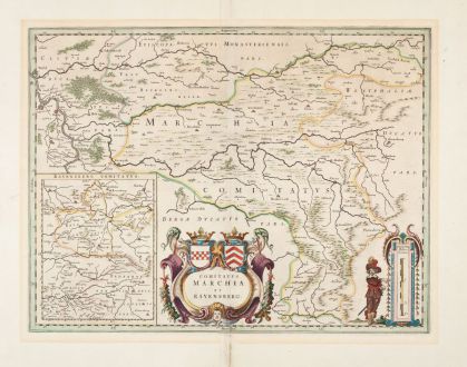
Comitatus Marchia et Ravensberg
Willem Janszoon Blaeu (*1571 - †1638)Reference 12973
Description
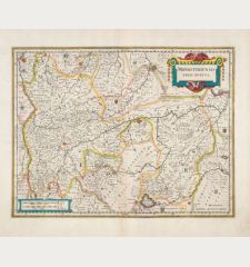
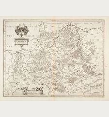
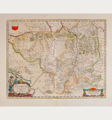
Antique map of the counties of Mark and Ravensberg by W. J. Blaeu. At the bottom centre a large cartouche with the coats of arms of the two counties. At the bottom left a small map of the county of Ravensberg. With Wesel, Dorsten, Dinslaken, Moers, Duisburg, Essen, Hattingen, Bochum, Dortmund and Hagen.
First published in Blaeu's Atlas Theatrum Orbis Terrarum in 1634. This example has no text on the back and comes from the early edition of the atlas from 1634-35.
Details
| Cartographer | Willem Janszoon Blaeu |
| Title | Comitatus Marchia et Ravensberg |
| Publisher, Year | Joan Blaeu, Amsterdam, circa 1635 |
| Plate Size | 38.3 x 50.1 cm (15.1 x 19.7 inches) |
| Sheet Size | 52.9 x 61.5 cm (20.8 x 24.2 inches) |
| Reference | Van der Krogt, P.: Koeman's Atlantes Neerlandici, 2387:2 |
Condition
Cartographer
Images to Download
If you like to download the image of this map with a resolution of 1200 pixels, please follow the link below.
You can use this image for publication on your personal or commercial websites for free if you set a link to this website. If you need photographs with a higher resolution, please contact us.
North Rhine-Westphalia - Blaeu, Willem Janszoon - Comitatus Marchia et Ravensberg

![Westfalia cum Dioecesi Bremensi [2 Karten] Westfalia cum Dioecesi Bremensi [2 Karten]](https://www.vintage-maps.com/4256-home_default/mercator-germany-lower-saxony-1633.jpg)
![[Kleve, Duisburg, Emmerich, Gennep] Cliviam, Ducatus Clivensis - Duisburgum - Embrica, Clivensis ditionis - Gennapium... [Kleve, Duisburg, Emmerich, Gennep] Cliviam, Ducatus Clivensis - Duisburgum - Embrica, Clivensis ditionis - Gennapium...](https://www.vintage-maps.com/3818-home_default/braun-hogenberg-north-rhine-westphalia-emmerich-duisburg-kleve.jpg)
![Madrid [El Escorial] Madrid [El Escorial]](https://www.vintage-maps.com/3756-home_default/blaeu-spain-portugal-madrid-el-escorial-1635.jpg)