Product successfully added to your shopping cart
There are 0 items in your cart. There is 1 item in your cart.
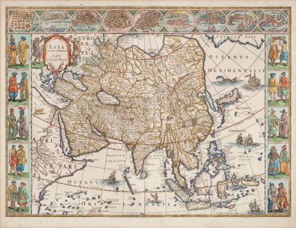
Asia noviter delineata
Willem Janszoon Blaeu (*1571 - †1638)Reference 12856
Description
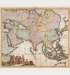
One of the most beautiful maps of Asia of the 17th century.
Willem Blaeu's map of Asia is one of the most beautiful maps of the continent published during the 17th century. It features ten pairs of figures representing various Asian cultures and highlights nine cities, showcasing the lucrative trade opportunities for Europeans.
Blaeu's map, influenced by Dutch East India Company charts, is notably up-to-date for its time. However, some details may seem surprising to modern viewers. Korea is portrayed as an almost isolated island, and Japan appears in a horizontal style typical of the period. Some of the coastlines are still incomplete and inaccurate, especially in Borneo and Southeast Asia.
The map shows the Fretium Anian, or the Strait of Anian, representing the hoped-for Northwest Passage between North America and Asia. The term Anian originates from Marco Polo's travels, but its location was inaccurately placed on the northwest coast of North America. This representation persisted until the mid-18th century.
Embellishments abound, depicting ships in battle, a whale being fired upon, and a merman blowing a conch shell. On land, a lion oversees the scene from eastern Africa, the Great Wall of China is detailed, and a camel accompanies it. A purposeful elephant is near Lake Chismay, considered the Ganges source. The map's title cartouche, placed in Europe, emphasizes its newly delineated nature.
The decorative style extends to pairs of figures bordering the map, representing diverse Asian cultures. Major trade centers like Kandy, Calcutta, Goa, Damascus and Macao are highlighted, emphasizing the vital trade routes connecting Europe to Asia for spices, porcelain, silks, and other luxury goods.
The map comes from the German edition of the Theatrum Orbis Terrarum by Joan and Cornelis Blaeu, published in Amsterdam in 1641/42, German text on verso.
Details
| Cartographer | Willem Janszoon Blaeu |
| Title | Asia noviter delineata |
| Publisher, Year | Amsterdam, 1641-42 |
| Plate Size | 41.1 x 55.5 cm (16.2 x 21.9 inches) |
| Sheet Size | 49.2 x 58.0 cm (19.4 x 22.8 inches) |
| Reference | Van der Krogt, P.: Koeman's Atlantes Neerlandici, 8000:2. |
Condition
Cartographer
Images to Download
If you like to download the image of this map with a resolution of 1200 pixels, please follow the link below.
You can use this image for publication on your personal or commercial websites for free if you set a link to this website. If you need photographs with a higher resolution, please contact us.
Asian Continent - Blaeu, Willem Janszoon - Asia noviter delineata

