Product successfully added to your shopping cart
There are 0 items in your cart. There is 1 item in your cart.
Africae nova descriptio
Willem Janszoon Blaeu (*1571 - †1638)Reference 12857
Description
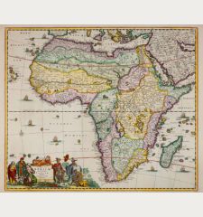
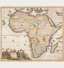
One of the most sought after maps of Africa.
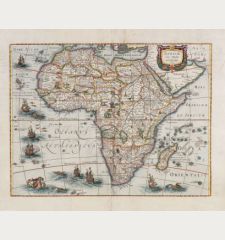
A very good example of Blaeu's iconic 17th-century map of Africa. It features the African continent with the Arabian Peninsula in the upper right corner and Madagascar to the lower right. Notably, the map reflects the intense exploration of the Indian Ocean islands following Vasco da Gama's 1498 journey to India via the Cape of Good Hope.
Blaeu crafted this map before the Dutch settled at the Cape, so place names there denote its use as a stopping point for ships, not a budding colonial settlement. The continent is divided into political units, decorated with elephants, lions, monkeys, and ostriches. Noteworthy features include two large lakes in the south, influencing the Nile's depiction, and another smaller lake, Sachaf lacus, giving rise to the Zambezi River.
Major African cities adorn the top border, offering a glimpse into the vibrant port economies of the 17th century. Drawings along the sides showcase local dress from various African cultures, reflecting the continent's diversity through European eyes. The seas are teeming with life - flying fishes, ships, and sea monsters - while a beautifully decorated compass rose and a lion-adorned cartouche enhance the map's visual appeal. The title Africae nova descriptio and the author's name are elegantly featured within the cartouche on the Arabian Peninsula.
The map comes from the German edition of the Theatrum Orbis Terrarum by Joan and Cornelis Blaeu, published in Amsterdam in 1641/42. Curiously, the text of the map of America is printed on verso, making this map unique.
Details
| Cartographer | Willem Janszoon Blaeu |
| Title | Africae nova descriptio |
| Publisher, Year | Amsterdam, 1641-42 |
| Plate Size | 40.9 x 55.1 cm (16.1 x 21.7 inches) |
| Sheet Size | 45.4 x 59.2 cm (17.9 x 23.3 inches) |
| Reference | Van der Krogt, P.: Koeman's Atlantes Neerlandici, 8600:2. |
Condition
Cartographer
Images to Download
If you like to download the image of this map with a resolution of 1200 pixels, please follow the link below.
You can use this image for publication on your personal or commercial websites for free if you set a link to this website. If you need photographs with a higher resolution, please contact us.
Africa Continent - Blaeu, Willem Janszoon - Africae nova descriptio


