Product successfully added to your shopping cart
There are 0 items in your cart. There is 1 item in your cart.
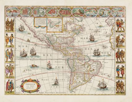
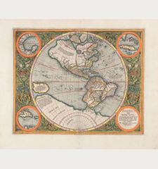
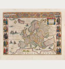
Americae nova Tabula
Willem Janszoon Blaeu (*1571 - †1638)Reference 12854
Description
One of the most sought after maps of America.
A stunning old colored example of Willem J. Blaeu's map of America from the Golden Age of Dutch Cartography. With decorative panels of portraits and city views. From the most expensive book published in the 17th century, an eleven-volume atlas containing 593 hand-colored maps. Blaeu's maps of the continents represent the apogee of seventeenth century Dutch cartography.
Willem Janszoon, later known as Blaeu, began issuing separately published maps in 1604, primarily focusing on sea atlases. Despite creating wall maps of the continents in 1608, it wasn't until 1617 that he embarked on the project of single-sheet versions.
While the map's geography aligns with the wall map and doesn't reflect many cartographical advancements between 1608 and 1617, it notably includes Henry Hudson’s Bay. This map of America is one of the few by Blaeu, featuring three decorative borders. The upper border showcases nine plans or views of towns (La Habana, Santo Domingo, Cartagena, Mexico City, Cusco, Potosi, La Mocha, Rio de Janeiro and Olinda), while the side panels each display five portraits drawn from various sources, including Theodore de Bry.
1616 revelations from Jacob le Maire and Willem Cornelisz Schouten's voyage around Cape Horn indicated that Tierra del Fuego was an island, not part of the unknown southern continent. Due to legal disputes between the English and the Dutch East India Companies, Blaeu was prohibited from incorporating this information into his maps and globes until August 1618. Promptly after, he updated his work to include Fretum le Maire and State landt, removing the coastline of Terra Australis Incognita east of the title cartouche, leaving only the name and the coast line left of the cartouche behind. After Blaeu's death in 1638, the business passed to his sons, Cornelis and Joan. Joan played a pivotal role in the production of the multi-volume Atlas Major. Unfortunately, a fire in 1672 destroyed the firm's cartographic production. While some plates were dispersed at auction, the America map didn't seem to be reused.
The known states of the map are summarized below:
- State 1 (1617): No le Maire Strait. Name Auct- Guiljel: Janssonio in cartouche.
- State 2 (1618): New islands in the South Pacific, le Maire Strait added, Terra del Fuogo now an island, and part of the southern continental coastline removed.
- State 3 (1621): Name in the title cartouche altered to Auct: Guiljelmo Blaeuw. Found both with and without text on the reverse, sometimes incorrectly distinguished as different states.
- State 4 (1642): Newly engraved sea around some decorative embellishments, notably in the square marked by latitudes 10° and 20° south, and 240° and 250° longitude.
- State 5 (1645): Further retouching in the same area as state 4, with harsh horizontal straight lines lacking any wave.
Details
| Cartographer | Willem Janszoon Blaeu |
| Title | Americae nova Tabula |
| Publisher, Year | Amsterdam, 1645-65 |
| Plate Size | 41.0 x 55.5 cm (16.1 x 21.9 inches) |
| Sheet Size | 51.0 x 64.2 cm (20.1 x 25.3 inches) |
| Reference | Burden, P.D.: The Mapping of North America No. 189.5; Van der Krogt, P.: Koeman's Atlantes Neerlandici, 9000:2. |
Condition
Cartographer
Images to Download
If you like to download the image of this map with a resolution of 1200 pixels, please follow the link below.
You can use this image for publication on your personal or commercial websites for free if you set a link to this website. If you need photographs with a higher resolution, please contact us.
America Continent - Blaeu, Willem Janszoon - Americae nova Tabula

