Product successfully added to your shopping cart
There are 0 items in your cart. There is 1 item in your cart.
Exactissima Asiae Delineatio...
Theodorus Danckerts (*1663 - †1727)Reference 12862
Description
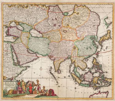
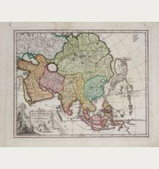
Beautiful antique map of the Asian continent and East Indies by Theodor Danckerts. It is a close copy of de Wit's map of Asia, with the notable differences. The map vividly captures the extent of European knowledge of the region, offering detailed insights, particularly in the south and southeast, drawing from surveys conducted by the Dutch East India Company. Aslo the northern part of Australia is included, called Hollandia Nova.
The influence of Jesuit missionaries is evident in the well-documented portrayal of China, while information about northern and central Asia is comparatively limited. The Caspian Sea is presented in an oval shape, oriented east-west, and the mythical Chiamai Lacus is illustrated with its five principal rivers. A large title cartouche with merchants, parrots and a camel at the bottom left.
Crafted by the esteemed Danckerts family of Amsterdam, recognized as one of the most distinguished cartographic families in the 17th century, this map reflects the artistry of some of the world's finest draughtsmen and engravers. The Danckerts family is renowned for producing some of the finest atlases of the period, contributing significantly to the cartographic landscape. This particular copy stands out as a fine example, enhanced by meticulous watercoloring executed at the time of its creation.
Details
| Cartographer | Theodorus Danckerts |
| Title | Exactissima Asiae Delineatio... |
| Publisher, Year | T. Danckerts, Amsterdam, circa 1685 |
| Plate Size | 49.4 x 57.2 cm (19.4 x 22.5 inches) |
| Sheet Size | 52.5 x 59.5 cm (20.7 x 23.4 inches) |
Condition
Cartographer
Images to Download
If you like to download the image of this map with a resolution of 1200 pixels, please follow the link below.
You can use this image for publication on your personal or commercial websites for free if you set a link to this website. If you need photographs with a higher resolution, please contact us.
Asian Continent - Danckerts, Theodorus - Exactissima Asiae Delineatio...

