Product successfully added to your shopping cart
There are 0 items in your cart. There is 1 item in your cart.
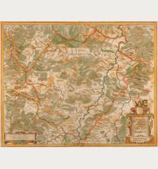
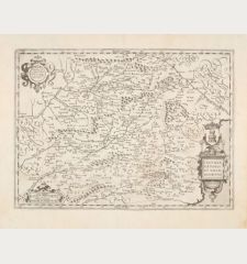
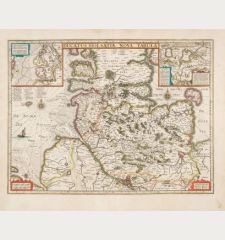
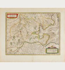
Osnabrugensis Episcopatus. Autore Ioanne Gigante.
Jodocus Hondius (*1563 - †1612)Reference 12791
Description
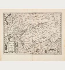
Beautiful engraved map of the Osnabrück region drawn by Joannes Gigas, published by J. Hondius. With Quakenbrück, Melle, Wittlage, Iburg, Bentlage und Lingen. One cartouche with a cityview of Osnabrück, coats-of-arm, mileage scale and an inset map of Wiedenbruck. This is the rare first state of the map and comes from the French edition of the Atlas Novus, published in 1633.
Details
| Cartographer | Jodocus Hondius |
| Title | Osnabrugensis Episcopatus. Autore Ioanne Gigante. |
| Publisher, Year | Henricus Hondius, Amsterdam, 1633 |
| Plate Size | 37.2 x 47.8 cm (14.6 x 18.8 inches) |
| Sheet Size | 48.0 x 57.2 cm (18.9 x 22.5 inches) |
| Reference | Van der Krogt, P.: Koeman's Atlantes Neerlandici, 2340:1.1 |
Condition
Cartographer
Images to Download
If you like to download the image of this map with a resolution of 1200 pixels, please follow the link below.
You can use this image for publication on your personal or commercial websites for free if you set a link to this website. If you need photographs with a higher resolution, please contact us.
Lower Saxony - Hondius, Jodocus - Osnabrugensis Episcopatus. Autore Ioanne...


![Westfalia cum Dioecesi Bremensi [2 Karten] Westfalia cum Dioecesi Bremensi [2 Karten]](https://www.vintage-maps.com/4256-home_default/mercator-germany-lower-saxony-1633.jpg)


![Bravnsweich [Braunsweich], Rostochium [Rostock] Bravnsweich [Braunsweich], Rostochium [Rostock]](https://www.vintage-maps.com/3155-home_default/saur-germany-lower-saxony-braunschweig-rostock-1595.jpg)
![Aldenburg [Aldenbvrg] Aldenburg [Aldenbvrg]](https://www.vintage-maps.com/2177-home_default/muenster-germany-lower-saxony-stade-1574.jpg)
