Product successfully added to your shopping cart
There are 0 items in your cart. There is 1 item in your cart.
Total products
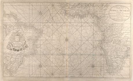
Nieuwe Wassende Graadige Pas-kaart van de Kust van Guinea en Brasilia strekkende van...
Johannes van Keulen (*1654 - †1711)Sea chart of South America, Africa, Sea Chart. Printed in Amsterdam by J. v. Keulen circa 1720.
Reference 10419
Description
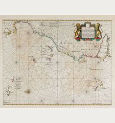
Very large scale seachart of the Atlanic Ocean from J. van Keulen. Showing the west coast of Africa down to South Africa and Brasil in the West. Exceptional for a nautical chart, a lot of inland details are shown in Africa and Brasil. With one large cartouche in Brasil.
Details
| Cartographer | Johannes van Keulen |
| Title | Nieuwe Wassende Graadige Pas-kaart van de Kust van Guinea en Brasilia strekkende van Cap-Verde tot de Cap de Bon-Esperance en Verders van Rio de Berbice tot Rio de la Plata te Amsterdam by Joannes van Keulen. |
| Publisher, Year | J. v. Keulen, Amsterdam, circa 1720 |
| Plate Size | 58.0 x 98.5 cm (22.8 x 38.8 inches) |
| Sheet Size | 63.0 x 102.0 cm (24.8 x 40.2 inches) |
| Reference | Tooley, Africa p. 52 |
Condition
Professional restored crease in left area, several small creases in margin repaired, to small green spots left to south Africa. Overall in very good decorative condition.
Cartographer
Johannes van Keulen, born in 1654, was a bookseller in Amsterdam and funded a publishing company in 1678. The family owned company was successful until middle of 19th century, also the sons and grandsons of Johannes had large contribution. The two major atlases have been the Zee Atlas first published 1680 and the Zee-Fakkel first printed 1681 with editions up to 1803. He died in 1711.
Images to Download
If you like to download the image of this map with a resolution of 1200 pixels, please follow the link below.
You can use this image for publication on your personal or commercial websites for free if you set a link to this website. If you need photographs with a higher resolution, please contact us.
Johannes van Keulen: Nieuwe Wassende Graadige Pas-kaart van de Kust van Guinea en Brasilia strekkende van Cap-Verde tot de Cap de Bon-Esperance....
Sea chart of South America, Africa, Sea Chart. Printed in Amsterdam by J. v. Keulen circa 1720.
Atlantic Ocean - Keulen, Johannes van - Nieuwe Wassende Graadige Pas-kaart van de...

![[Manuscript Chart of the South Atlantic Ocean] Tweede stuck wassende Graedkaert van de Kaap Verdische Eilanden tot de Kaap [Manuscript Chart of the South Atlantic Ocean] Tweede stuck wassende Graedkaert van de Kaap Verdische Eilanden tot de Kaap](https://www.vintage-maps.com/3745-home_default/blaeu-manuscript-1690.jpg)

![[Canary Islands] [Canary Islands]](https://www.vintage-maps.com/3021-home_default/bordone-spain-portugal-canaries-tenerife-gran-canaria.jpg)
![[Porto Santo and Madeira] [Porto Santo and Madeira]](https://www.vintage-maps.com/3025-home_default/bordone-spain-portugal-porto-santo-madeira-1528-1565.jpg)
