Product successfully added to your shopping cart
There are 0 items in your cart. There is 1 item in your cart.
Total products

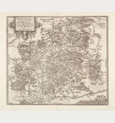
Geographischer Entwurf der beyden Freyen Reichs-Herrschaften Sulzbürg und Pirbaum samt...
Tobias Mayer (*1723 - †1762)Old coloured map of Oberpfalz, Bavaria. Printed in Nuremberg by Homann Erben in 1748.
Reference 11516
Description
Old coloured, highly detailed and rare fields map of Upper Palatinate. Covering the area between Nuremberg and Regensburg with Allersburg, Freystadt, Berching, Neumarkt and Pyrbaum.
Details
| Cartographer | Tobias Mayer |
| Title | Geographischer Entwurf der beyden Freyen Reichs-Herrschaften Sulzbürg und Pirbaum samt ihren auch incorporirten, in anderer Ständen Territoris aber liegenden Dorfschaften und Unterthanen |
| Publisher, Year | Homann Erben, Nuremberg, 1748 |
| Plate Size | 54.2 x 46.0 cm (21.3 x 18.1 inches) |
| Sheet Size | 62.0 x 53.5 cm (24.4 x 21.1 inches) |
Condition
Excellent condition.
Cartographer
Tobias Mayer was a mathematician and astronomer born in Marbach, Germany. During the years 1746-1751 he worked in the map publishing house of Homann Heirs in Nuremberg. His cartographic work consists of some 30 maps.
Images to Download
If you like to download the image of this map with a resolution of 1200 pixels, please follow the link below.
You can use this image for publication on your personal or commercial websites for free if you set a link to this website. If you need photographs with a higher resolution, please contact us.
Tobias Mayer: Geographischer Entwurf der beyden Freyen Reichs-Herrschaften Sulzbürg und Pirbaum samt ihren auch incorporirten, in anderer....
Old coloured map of Oberpfalz, Bavaria. Printed in Nuremberg by Homann Erben in 1748.
Germany - Mayer, Tobias - Geographischer Entwurf der beyden Freyen...

![[Donau Strom von Sigmaringen bis Donauwörth] [Donau Strom von Sigmaringen bis Donauwörth]](https://www.vintage-maps.com/2606-home_default/anonymous-germany-baden-wuerttemberg-danube-1702.jpg)



![[De Boemia. / Tabula quarta & quinta Europae de nonnullis / Germaniae ...] [De Boemia. / Tabula quarta & quinta Europae de nonnullis / Germaniae ...]](https://www.vintage-maps.com/2304-home_default/fries-germany-1541.jpg)
