Product successfully added to your shopping cart
There are 0 items in your cart. There is 1 item in your cart.
Total products
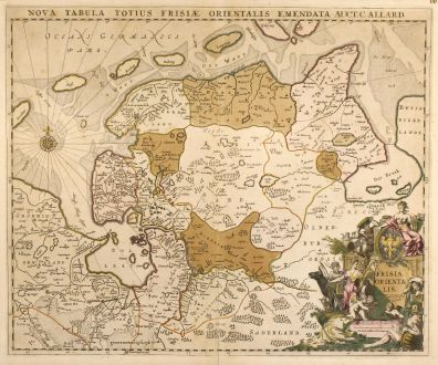
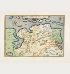
Nova Tabula Totius Frisiae Orientalis Emendata Auct. C. Allard
Carel Allard (*1648 - †1709)Old coloured map of Friesland. Printed in Amsterdam by C. Allard circa 1697.
Reference 10459
Description
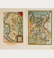
Cooper engraved map of East Friesland by Carel Allard. Showing the North Sea coastal line of Friesland with Emden and the islands Borkum, Norderney, Langeoog, Spickeroog and Wanderooge. It's the last map of East Frisia from the Netherlands cartographers in line with the famous Emmius map. With one beautiful old coloured figurative cartouche and a compass rose.
Details
| Cartographer | Carel Allard |
| Title | Nova Tabula Totius Frisiae Orientalis Emendata Auct. C. Allard |
| Publisher, Year | C. Allard, Amsterdam, circa 1697 |
| Plate Size | 46.6 x 55.0 cm (18.3 x 21.7 inches) |
| Sheet Size | 49.0 x 58.5 cm (19.3 x 23.0 inches) |
Condition
Minor browning, centrefold and margin strengthened.
Cartographer
Hugh Allard and his son Carel were map and atlas publishers in the second half of seventeenth century in Amsterdam. The maps mainly based on those of J. Blaeu, N. Visscher, J. Janssonius and F. de Wit.
Images to Download
If you like to download the image of this map with a resolution of 1200 pixels, please follow the link below.
You can use this image for publication on your personal or commercial websites for free if you set a link to this website. If you need photographs with a higher resolution, please contact us.
Carel Allard: Nova Tabula Totius Frisiae Orientalis Emendata Auct. C. Allard.
Old coloured map of Friesland. Printed in Amsterdam by C. Allard circa 1697.
Germany - Allard, Carel - Nova Tabula Totius Frisiae Orientalis...

![[Donau Strom von Sigmaringen bis Donauwörth] [Donau Strom von Sigmaringen bis Donauwörth]](https://www.vintage-maps.com/2606-home_default/anonymous-germany-baden-wuerttemberg-danube-1702.jpg)



![[De Boemia. / Tabula quarta & quinta Europae de nonnullis / Germaniae ...] [De Boemia. / Tabula quarta & quinta Europae de nonnullis / Germaniae ...]](https://www.vintage-maps.com/2304-home_default/fries-germany-1541.jpg)
