Product successfully added to your shopping cart
There are 0 items in your cart. There is 1 item in your cart.
Total products
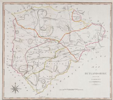
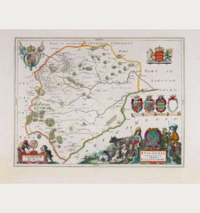
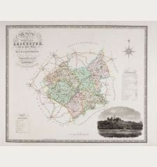
A Map of Rutlandshire from the best Authorities
John Cary (*1755 - †1835)Old coloured map of Rutland, England. Printed in London by John Stockdale in 1805.
Reference 11911
Description
Antique map of Rutland by John Cary from John Stockdale's New British Atlas of 1805. The map was first published by Richard Gough in the 1789 edition of Camden's Britannia. Shows the county with important streets and cities. With a compass rose.
Details
| Cartographer | John Cary |
| Title | A Map of Rutlandshire from the best Authorities |
| Publisher, Year | John Stockdale, London, 1805 |
| Plate Size | 42.3 x 47.0 cm (16.7 x 18.5 inches) |
| Sheet Size | 44.5 x 50.8 cm (17.5 x 20.0 inches) |
Condition
Very good condition.
Cartographer
John Cary was an English map publisher and engraver, active in London between 1787 and 1834. His very clear and discreetly shaded maps appeared in the 1789 edition of Camden's Britannia by Richard Gough John Stockdale's New British Atlas of 1805.
Images to Download
If you like to download the image of this map with a resolution of 1200 pixels, please follow the link below.
You can use this image for publication on your personal or commercial websites for free if you set a link to this website. If you need photographs with a higher resolution, please contact us.
John Cary: A Map of Rutlandshire from the best Authorities.
Old coloured map of Rutland, England. Printed in London by John Stockdale in 1805.
British Isles - Cary, John - A Map of Rutlandshire from the best...


![[British Isles and England & Wales] [British Isles and England & Wales]](https://www.vintage-maps.com/2941-home_default/bordone-british-isles-england-and-wales-1528-1565.jpg)
![[The Firth of Murry] - To the Rt Hon.ble, my Lord Viscount Torbat, Lord Register of the Kingdom of Scotland [The Firth of Murry] - To the Rt Hon.ble, my Lord Viscount Torbat, Lord Register of the Kingdom of Scotland](https://www.vintage-maps.com/2244-home_default/collins-scotland-north-sea-moray-firth-inverness.jpg)
