Product successfully added to your shopping cart
There are 0 items in your cart. There is 1 item in your cart.
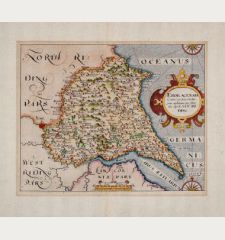
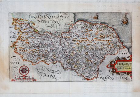
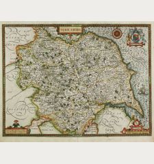
Eboracensis Comitatus pars Septentrionalis, vulgo North Riding
William KipReference 11883
Description
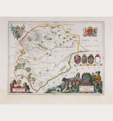
Antique map of Yorkshire by William Kip from William Camden's Britannia; Sive Florentissimorum Regnorum, Angliae, Scotiae, Hiberniae, Et Insularum. The map is based on the surveys of Christopher Saxton and was first added to the Britannia in 1607. The maps of the 1607 edition have partially Latin text on verso, the 1610 edition lacks the text and the 1637 edition displays a plate number in the lower corner. This example comes from the 1607 editon of the Britannia, with latin text on verso. With a beautiful title cartouche, a compass rose and two sailing ships.
Details
| Cartographer | William Kip |
| Title | Eboracensis Comitatus pars Septentrionalis, vulgo North Riding |
| Publisher, Year | George Bishop, London, 1607 |
| Plate Size | 19.5 x 34.4 cm (7.7 x 13.5 inches) |
| Sheet Size | 30.8 x 40.0 cm (12.1 x 15.7 inches) |
Condition
Cartographer
Images to Download
If you like to download the image of this map with a resolution of 1200 pixels, please follow the link below.
You can use this image for publication on your personal or commercial websites for free if you set a link to this website. If you need photographs with a higher resolution, please contact us.
British Isles - Kip, William - Eboracensis Comitatus pars...


![[British Isles and England & Wales] [British Isles and England & Wales]](https://www.vintage-maps.com/2941-home_default/bordone-british-isles-england-and-wales-1528-1565.jpg)
![[The Firth of Murry] - To the Rt Hon.ble, my Lord Viscount Torbat, Lord Register of the Kingdom of Scotland [The Firth of Murry] - To the Rt Hon.ble, my Lord Viscount Torbat, Lord Register of the Kingdom of Scotland](https://www.vintage-maps.com/2244-home_default/collins-scotland-north-sea-moray-firth-inverness.jpg)
