Product successfully added to your shopping cart
There are 0 items in your cart. There is 1 item in your cart.
Total products
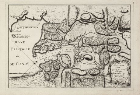
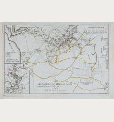
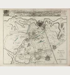
L'Isthme de l'Acadie Baye du Beaubassin en Anglois Shegnekto. Environs du Fort Beausejour.
George Louis le Rouge (*1707 - †1790)Antique map of Nova Scotia, Acadia, Canada. Printed in Paris by le Rouge in 1755.
Reference 10972
Description
Important and very rare map describing the first battle of the French and Indian War in Canada in 1755
The copper engraved map published by G. L. le Rouge in 1755 showing the Chignecto isthmus which was the location of a dividing line between the British region of Nova Scotia and the French territory. The French built Fort Beausejour on the Aulac Ridge in 1750, while the British constructed Fort Lawrence, called Ft. St. Laurent in this map. The map establishes the context of the brief battle between the French and the British in 1755.
Only a few examples of this separately issued map are known. One is in the Bibliotheque et Archives Canada and an other example is listed in an 1889 map catalogue: Le bibliophile americain with the comment: "Très jolie carte gravée à l'eau forte." Also Jefferys published a version of the map in 1755. It is not clear which map came first, but Jeffres map is dated August and this one June 1755.
Details
| Cartographer | George Louis le Rouge |
| Title | L'Isthme de l'Acadie Baye du Beaubassin en Anglois Shegnekto. Environs du Fort Beausejour. |
| Publisher, Year | le Rouge, Paris, 1755 |
| Plate Size | 38.0 x 44.3 cm (15.0 x 17.4 inches) |
| Sheet Size | 36.0 x 53.0 cm (14.2 x 20.9 inches) |
Condition
Dark and clear impression on strong paper. Perfect condition. It is quite unusual to find a separate published map in such preservation.
Cartographer
G. L. le Rouge was a French military engineer, hydrographer and cartographer. He produced a wide rang of attractive cartographic work. He held a position of Geographical Engineer to King Louis XV.
Images to Download
If you like to download the image of this map with a resolution of 1200 pixels, please follow the link below.
You can use this image for publication on your personal or commercial websites for free if you set a link to this website. If you need photographs with a higher resolution, please contact us.
George Louis le Rouge: L'Isthme de l'Acadie Baye du Beaubassin en Anglois Shegnekto. Environs du Fort Beausejour..
Antique map of Nova Scotia, Acadia, Canada. Printed in Paris by le Rouge in 1755.
North America - le Rouge, George Louis - L'Isthme de l'Acadie Baye du Beaubassin en...

