Product successfully added to your shopping cart
There are 0 items in your cart. There is 1 item in your cart.
Total products
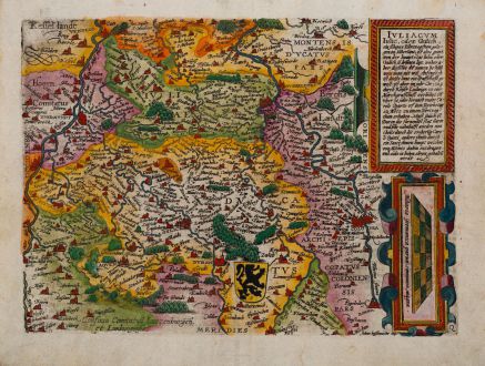
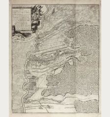
Iuliacum, Iulic, oder Gulich. ein schönes Hertzogthum gelegen im Niderlant
Matthias Quad (*1557 - †1613)Coloured map of North Rhine-Westphalia. Printed in Cologne by J. Bussemacher circa 1600.
Reference 12399
Description
Antique map of North Rhine-Westphalia (Nordrhein-Westfalen) by Matthias Quad. Shows the area between Rhine and Meuse with Bonn, Cologne (Köln), Düsseldorf and Neuss to Venlo in the northeast. With Jülich in the centre. To the right a mileage scale, to the upper right a title cartouche. German text on verso. Printed in Cologne by Johann Bussemann around 1600.
Details
| Cartographer | Matthias Quad |
| Title | Iuliacum, Iulic, oder Gulich. ein schönes Hertzogthum gelegen im Niderlant |
| Publisher, Year | J. Bussemacher, Cologne, circa 1600 |
| Plate Size | 22.8 x 30.8 cm (9.0 x 12.1 inches) |
| Sheet Size | 26.7 x 35.0 cm (10.5 x 13.8 inches) |
Condition
Excellent conditions.
Cartographer
Matthias Quad, born in 1557, was a German cartographer active during the late 16th century in Cologne. His main geographical works Europae totius orbis terrarum and Geographisch Handtbuch were published and engraved by Johann Bussemacher. He died in 1613.
Images to Download
If you like to download the image of this map with a resolution of 1200 pixels, please follow the link below.
You can use this image for publication on your personal or commercial websites for free if you set a link to this website. If you need photographs with a higher resolution, please contact us.
Matthias Quad: Iuliacum, Iulic, oder Gulich. ein schönes Hertzogthum gelegen im Niderlant.
Coloured map of North Rhine-Westphalia. Printed in Cologne by J. Bussemacher circa 1600.
Germany - Quad, Matthias - Iuliacum, Iulic, oder Gulich. ein schönes...

![[Donau Strom von Sigmaringen bis Donauwörth] [Donau Strom von Sigmaringen bis Donauwörth]](https://www.vintage-maps.com/2606-home_default/anonymous-germany-baden-wuerttemberg-danube-1702.jpg)



![[De Boemia. / Tabula quarta & quinta Europae de nonnullis / Germaniae ...] [De Boemia. / Tabula quarta & quinta Europae de nonnullis / Germaniae ...]](https://www.vintage-maps.com/2304-home_default/fries-germany-1541.jpg)
