Product successfully added to your shopping cart
There are 0 items in your cart. There is 1 item in your cart.
Total products
The item displayed below has already been sold, but we have another similar one available:
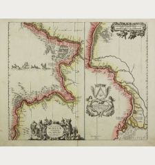
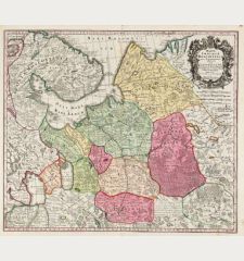
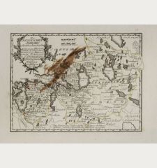
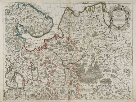
Carte de Moscovie. Dressee par Guillaume De l'Isle Premier Geographe du Roy.
Guillaume de l'Isle (*1675 - †1726)Old coloured map of Moscow, Moskwa. Printed in Paris in the year 1745.
Reference 11502
Description
Large, old coloured map of the western part of Russia by G. de l'Isle. The map is printed on two sheets, below size is for one sheet each. If joined, the size of the map is 119cm x 65.3cm. It shows the area of Murmansk in the northwest, the White Sea, Lake Onega, Lake Ladoga with St. Petersburg, up to the Pechora River in the northeast. In the southeast, the map reaches the northern tip of the Caspian Sea.
Details
| Cartographer | Guillaume de l'Isle |
| Title | Carte de Moscovie. Dressee par Guillaume De l'Isle Premier Geographe du Roy. |
| Publisher, Year | Paris, 1745 |
| Plate Size | 59.5 x 65.3 cm (23.4 x 25.7 inches) |
| Sheet Size | 62.6 x 69.0 cm (24.6 x 27.2 inches) |
Condition
In top margin two small tears around centrefold. Excellent condition.
Cartographer
The de L'Isle family was one of the most influential Geographers of the early 18th century in France. Claude de L'Isle, born 1644, had four sons, of which Guillaume was the most notable. Guillaume was born 1675 and became member of the Académie Royale des Sciences with the age of twenty-seven, and was honoured later with the title Premier Géographe du Roi. His largest project, the Atlas de Géographie, was published until 1774 in Paris and Amsterdam (Covens and Mortier). He died in 1726.
Images to Download
If you like to download the image of this map with a resolution of 1200 pixels, please follow the link below.
You can use this image for publication on your personal or commercial websites for free if you set a link to this website. If you need photographs with a higher resolution, please contact us.
Guillaume de l'Isle: Carte de Moscovie. Dressee par Guillaume De l'Isle Premier Geographe du Roy..
Old coloured map of Moscow, Moskwa. Printed in Paris in the year 1745.
Russia - de l'Isle, Guillaume - Carte de Moscovie. Dressee par Guillaume...

![Verus Chersonesi Tauricae Seu Crimea Conspectus ... [and] Theatrum Belli Ao MDCCXXXVII ... [and] Explicatio Duarum Tabularum... Verus Chersonesi Tauricae Seu Crimea Conspectus ... [and] Theatrum Belli Ao MDCCXXXVII ... [and] Explicatio Duarum Tabularum...](https://www.vintage-maps.com/2205-home_default/du-chaffat-ukraine-russo-turkish-war-crimea-1740.jpg)
