Product successfully added to your shopping cart
There are 0 items in your cart. There is 1 item in your cart.
![Anonymous: [Korean Manuscript Map of Kyonggi-do with Seoul] Antique Maps, Anonymous, Japan - Korea, Kyonggi-do, Gyeonggi-do, Seoul: [Korean Manuscript Map of Kyonggi-do with Seoul]](https://www.vintage-maps.com/1813-large_default/anonymous-japan-korea-kyonggi-do-gyeonggi-do-seoul.jpg)
[Korean Manuscript Map of Kyonggi-do with Seoul]
AnonymousReference 11505
Description
Stunning Korean Manuscript Map of Kyonggi with Seoul from a Chonha-Chido.
An early 1800's Korean manuscript map of Kyonggi-do (Gyeonggi-do) with Seoul. The map comes from a traditional Korean manuscript atlas.
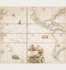
A traditional Korean manuscript Atlas Chonha-Chido (Atlas of the world) comprehends a map of the world Chonha-Do, a map of Korea, maps of China, Japan, the Ryukyu Islands and regional maps of the eight provinces of Korea.
Black ink on thin paper, wash colours in red and blue. The map was framed in Korea during the 1970s. It is laid down on fabric and spanned on a wooden frame with a size of 43 x 47cm.
Details
| Cartographer | Anonymous |
| Title | [Korean Manuscript Map of Kyonggi-do with Seoul] |
| Publisher, Year | circa 1820 |
| Plate Size | 26.8 x 31.2 cm (10.6 x 12.3 inches) |
| Sheet Size | 29.5 x 34.0 cm (11.6 x 13.4 inches) |
Condition
Images to Download
If you like to download the image of this map with a resolution of 1200 pixels, please follow the link below.
You can use this image for publication on your personal or commercial websites for free if you set a link to this website. If you need photographs with a higher resolution, please contact us.
Japan - Korea - Anonymous - [Korean Manuscript Map of Kyonggi-do with...

![Ch'onha Chido [Atlas of all under Heaven] Ch'onha Chido [Atlas of all under Heaven]](https://www.vintage-maps.com/3336-home_default/anonymous-korean-manuscript-atlas-chonha-chido-1820.jpg)
![Ch'onha Chido [Atlas of all under Heaven] Ch'onha Chido [Atlas of all under Heaven]](https://www.vintage-maps.com/4291-home_default/anonymous-korean-manuscript-atlas-chonha-chido-1800.jpg)
![Ch'onha chido [Atlas of all under Heaven] Ch'onha chido [Atlas of all under Heaven]](https://www.vintage-maps.com/3314-home_default/anonymous-korean-woodblock-atlas-chonha-chido-1750.jpg)
