Product successfully added to your shopping cart
There are 0 items in your cart. There is 1 item in your cart.
Total products
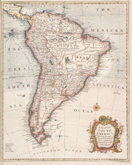
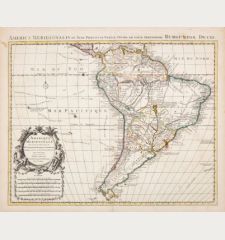
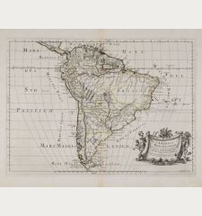
A Map of South America with All the European Settlements & Whatever Else is Remarkable...
Richard William Seale (*1703 - †1762)Coloured map of South America. Printed in London by R. W. Seale circa 1754.
Reference 12575
Description
Antique map of South America by Richard William Seale. With the Galápagos Islands and gold mines in Brazil. Beautiful title cartouche to the lower right.
Details
| Cartographer | Richard William Seale |
| Title | A Map of South America with All the European Settlements & Whatever Else is Remarkable from the Latest & Best Observations. |
| Publisher, Year | R. W. Seale, London, circa 1754 |
| Plate Size | 46.7 x 37.5 cm (18.4 x 14.8 inches) |
| Sheet Size | 50.2 x 40.0 cm (19.8 x 15.7 inches) |
Condition
Slightly browned in margins, small tear in upper margin. Very good condition.
Cartographer
Richard William Seale was an English engraver and map maker. He was active in London from 1740 until his death in 1762 and worked for many famous English cartographers of that time.
Images to Download
If you like to download the image of this map with a resolution of 1200 pixels, please follow the link below.
You can use this image for publication on your personal or commercial websites for free if you set a link to this website. If you need photographs with a higher resolution, please contact us.
Richard William Seale: A Map of South America with All the European Settlements & Whatever Else is Remarkable from the Latest & Best Observations..
Coloured map of South America. Printed in London by R. W. Seale circa 1754.
South America - Seale, Richard William - A Map of South America with All the...

![[West Indies, Jamaica, Hispaniola and South America] [West Indies, Jamaica, Hispaniola and South America]](https://www.vintage-maps.com/3035-home_default/bordone-central-america-caribbean-jamaica-hispaniola.jpg)
