Product successfully added to your shopping cart
There are 0 items in your cart. There is 1 item in your cart.
Total products
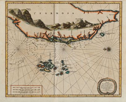
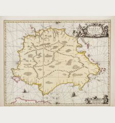
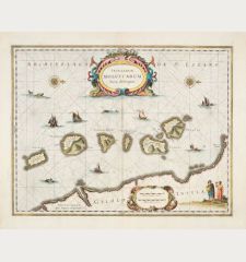
L'Ile de Formosa, ou sont exactement marquez les bancs de sables, rochers et brasses...
Pieter van der Aa (*1659 - †1733)Coloured sea chart of Formosa, Taiwan. Printed in Leyden by P. van der Aa circa 1720.
Reference 11480
Description
A rare sea chart showing the southwest part of Taiwan (Formosa) together with the Penghu Islands (Pescadores). Oriented to the east.
From Galerie Agréable du Monde, a sixty-six volume atlas complied in 1729 and said to have been issued in an edition of 100 copies only (Tooley, p. 1). One of the few maps related to Taiwan available to collectors.
Details
| Cartographer | Pieter van der Aa |
| Title | L'Ile de Formosa, ou sont exactement marquez les bancs de sables, rochers et brasses d'eau, le tout fait... |
| Publisher, Year | P. van der Aa, Leyden, circa 1720 |
| Plate Size | 28.9 x 34.9 cm (11.4 x 13.7 inches) |
| Sheet Size | 31.4 x 39.0 cm (12.4 x 15.4 inches) |
Condition
Some overall browning. A library stamps on verso. Good conditions.
Cartographer
Pieter van der Aa was born 1659 in Leyden, Holland. He started his own book publishing business when he was twenty-three. Within fifty years in his business, he published a huge amount of highly decorative maps and atlases. His Nouvel Atlas was reissued by Covens & Mortier. He died 1733 in Leyden.
Images to Download
If you like to download the image of this map with a resolution of 1200 pixels, please follow the link below.
You can use this image for publication on your personal or commercial websites for free if you set a link to this website. If you need photographs with a higher resolution, please contact us.
Pieter van der Aa: L'Ile de Formosa, ou sont exactement marquez les bancs de sables, rochers et brasses d'eau, le tout fait....
Coloured sea chart of Formosa, Taiwan. Printed in Leyden by P. van der Aa circa 1720.
Southeast Asia - Aa, Pieter van der - L'Ile de Formosa, ou sont exactement...


![[Maidegascar, Zanzibar, Scorsia, Inebila, Imangla, Scilam, Dondina] [Maidegascar, Zanzibar, Scorsia, Inebila, Imangla, Scilam, Dondina]](https://www.vintage-maps.com/2957-home_default/bordone-east-africa-madagascar-sri-lanka-1528-1565.jpg)
![[Java Minore] [Java Minore]](https://www.vintage-maps.com/2959-home_default/bordone-southeast-asia-indonesia-sumatra-thailand-borneo.jpg)
