Product successfully added to your shopping cart
There are 0 items in your cart. There is 1 item in your cart.
Total products
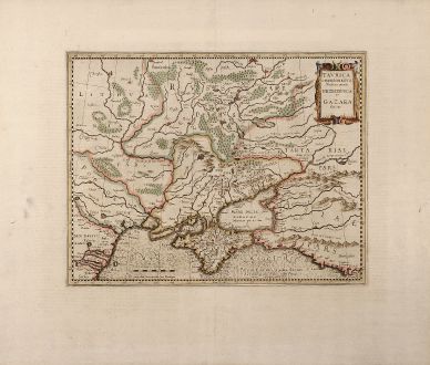
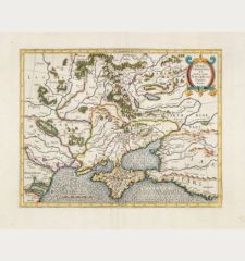
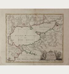
Tavrica Chersonesvs Nostra aetate Przecopsca et Gazara dicitur
Gerard Mercator (*1512 - †1594)Old coloured map of the Crimean Peninsula, Ukraine. Printed in Amsterdam by H. Hondius circa 1613.
Reference 10324
Description
Beautiful original old coloured Mercator map of The Ukraine with Crimean peninsula, including the northern part of the Black Sea and up to Smolensk in the North. This map comes from an English edition of the Mercator Hondius Atlases. English text on backside.
Details
| Cartographer | Gerard Mercator |
| Title | Tavrica Chersonesvs Nostra aetate Przecopsca et Gazara dicitur |
| Publisher, Year | H. Hondius, Amsterdam, circa 1613 |
| Plate Size | 31.8 x 40.5 cm (12.5 x 15.9 inches) |
| Sheet Size | 49.5 x 58.5 cm (19.5 x 23.0 inches) |
Condition
Centrefold backed with Japan paper. Excellent condition with wide margin.
Cartographer
Gerard Mercator (Kremer) was born in Rupelmonde in Flanders and studied in Louvain. He drawn his first map in 1537 and became a cartographer and globe maker. In 1552 he moved to Duisburg, Germany where he published his famous 18-sheet world map in 1569 with his own new projection, today called Mercator projection. Later he decided to publish a new edition of Ptolemy's Geographia. Followed by his major work, a 3 volume collection of maps to which the word Atlas was applied the first time. The first volume was published 1585, followed by the second in 1589 and the third one after his death in 1595 by his son Rumold. A second edition of all three parts was published 1602. 1604 Jodocus Hondius acquired the plates and published several edition together with his sons Jodocus II and Henricus until 1633. More editions followed until 1666 by Janssonius who was in partnership with Henricus. Some of the plated where also used by W.J. Blaeu in 1630.
Images to Download
If you like to download the image of this map with a resolution of 1200 pixels, please follow the link below.
You can use this image for publication on your personal or commercial websites for free if you set a link to this website. If you need photographs with a higher resolution, please contact us.
Gerard Mercator: Tavrica Chersonesvs Nostra aetate Przecopsca et Gazara dicitur.
Old coloured map of the Crimean Peninsula, Ukraine. Printed in Amsterdam by H. Hondius circa 1613.
Russia - Mercator, Gerard - Tavrica Chersonesvs Nostra aetate...

![Verus Chersonesi Tauricae Seu Crimea Conspectus ... [and] Theatrum Belli Ao MDCCXXXVII ... [and] Explicatio Duarum Tabularum... Verus Chersonesi Tauricae Seu Crimea Conspectus ... [and] Theatrum Belli Ao MDCCXXXVII ... [and] Explicatio Duarum Tabularum...](https://www.vintage-maps.com/2205-home_default/du-chaffat-ukraine-russo-turkish-war-crimea-1740.jpg)
