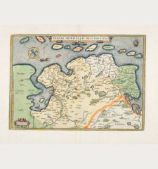
Product successfully added to your shopping cart
There are 0 items in your cart. There is 1 item in your cart.
Parergon, sive Veteris Geographiae aliquot Tabulae. [Bound with:] Nomenclator Ptolemaicus.
Abraham Ortelius (*1527 - †1598)Reference 11259
Description
Koeman notes to this atlas:
This atlas of ancient geography must be regarded as a personal work of Ortelius. For this work he did not, as in the 'Theatrum', copy other people's maps but drew the originals himself which were later engraved by Jan Wierix ... The maps in the Parergon have to be evaluated as the most outstanding engravings depicting the wide-spread interest in classical geography in the 16th century
Maps bound into this atlas:
Page number; Title; van den Broecke reference, State
A, Aevi Veteris Typus, 186, 1st state
B, Europam sive Celticam, 189, only state
C, Britannicarum Insularum, 192, only state
D, Hispaniae Veteris Descriptio, 193, undescribed state between 1st and 2nd
E, Gallia Vetus, 194, 2nd state
F, Galliae Veteris Typus, 196, 1st state
G, Belgii Veteris Typus, 198, 1st state
H, Germaniae Veteris Typus, 200, 1st state
I, Pannoniae et Illyrici Veteris Tabula, 203, only state
K, Italiae Veteris Specimen, 204, 2nd state
L, Italia Gallica sive Gallia Cisalpina, 206, undescribed state between 1st and 2nd
M, Tusciae Antiquae Typus, 208, 1st state
N, Latium, 209, 1st state
N (old manuscript O), Graecia Maior, 210, 1st state
P, Siciliae Veteris Typus, 211, 4th state
Q, Hellas, Graecia Sophiani, 215, 2nd state
R, Thraciae Veteris Typus, 214, 2nd state
S, Daciarum Moesiarumque, 212, 1st state
T, Pontus Euxinus, 213, 1st state
V, Creta, 217, 2nd state
X, Insular Aliquot - Cyprus, 216, undescribed state between 2nd and 3rd
Y, Alexandri Magni Macedonis, 222, 1st state
Z, Palaestinae Sive Totius, 172, only state
a, Typus Chorographicus, 180, 1st state
b, Aegyptus Antiqua, 221, only state
c, Africae Propriae Tabula, 218, 1st state
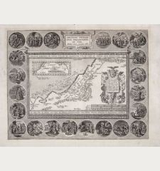
d, Peregrinationis Divi Pauli, 181, 2nd state
e, Abrahami Patriarchae, 182, 1st state
f, Aeneae Troiani Navigatio, 223, 1st state
g, Romani Imperii Imago, 187, 2nd state
h, Tempe, 231, 1st state
i, Daphne, 232, 1st state
Details
| Cartographer | Abraham Ortelius |
| Title | Parergon, sive Veteris Geographiae aliquot Tabulae. [Bound with:] Nomenclator Ptolemaicus. |
| Publisher, Year | Plantin, Antwerp, 1595 |
| Size | 44.3 x 28.5 cm (17.4 x 11.2 inches), Folio |
| Illustrations | 1 engraved portrait, 1 woodcut title border, 30 copper engraved maps, 2 engraved views, several woodcuts in text |
| Cover | Calf binding |
| Volume | 2 parts in 1 volume |
| Reference | Koeman Ort 45 & Ort 44; Adams O-340 (bound with Theatrum) |
Condition
Contemporary blind-ruled calf, in a brown cloth slipcase. Rebacked with title stamped in gold, corners and edges restored.
All maps and views finely coloured by a contemporary hand. Very good paper quality, no oxidation for the colours. Occasional light marginal soiling or spotting. Some tears in lower centrefolds backed. Map of Britain lightly browned, Divi Pauli with a tear left to centrefold restored.
Cartographer
Images to Download
If you like to download the image of this map with a resolution of 1200 pixels, please follow the link below.
You can use this image for publication on your personal or commercial websites for free if you set a link to this website. If you need photographs with a higher resolution, please contact us.
Atlases - Ortelius, Abraham - Parergon, sive Veteris Geographiae aliquot...

![Abraham Ortelius: Parergon, sive Veteris Geographiae aliquot Tabulae. [Bound with:] Nomenclator Ptolemaicus. Atlases, Ortelius, Atlas Parergon, 1595: Parergon, sive Veteris Geographiae aliquot Tabulae. [Bound with:] Nomenclator Ptolemaicus.](https://www.vintage-maps.com/1461-large_default/ortelius-atlas-parergon-1595.jpg)
![Ch'onha Chido [Atlas of all under Heaven] Ch'onha Chido [Atlas of all under Heaven]](https://www.vintage-maps.com/3336-home_default/anonymous-korean-manuscript-atlas-chonha-chido-1820.jpg)
![Ch'onha Chido [Atlas of all under Heaven] Ch'onha Chido [Atlas of all under Heaven]](https://www.vintage-maps.com/4291-home_default/anonymous-korean-manuscript-atlas-chonha-chido-1800.jpg)
![Ch'onha chido [Atlas of all under Heaven] Ch'onha chido [Atlas of all under Heaven]](https://www.vintage-maps.com/3314-home_default/anonymous-korean-woodblock-atlas-chonha-chido-1750.jpg)

