Product successfully added to your shopping cart
There are 0 items in your cart. There is 1 item in your cart.
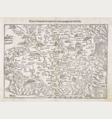
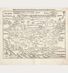
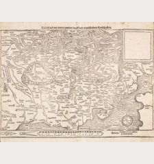
Landtafel des Ungerlands, Polands, Reussen, Littaw, Walachei, Bulgarei
Sebastian Münster (*1489 - †1552)Reference 12989
Description
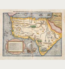
Rare early woodcut map of Eastern Europe by Sebastian Munster. It offers a detailed depiction of Poland, Lithuania, Ukraine, Moscovy, and the Balkans, extending geographically from Prussia, Vilna, and Smolensk in the north to Bosnia, Bulgaria, Istanbul (Constantinople), and the Crimea in the south, with Poland as the central focus.
The 1552 edition is particularly noteworthy for several unique features:
Grid Numbering System: It is the only known edition to incorporate additional grid numbers. An early and rare experiment in standardized placename indexing, setting it apart from both earlier and later prints.
Title Variation: This edition bears the Roman numeral "XX" in its title, a characteristic not shared by other versions. Earlier editions used "XV", while later versions omitted the Roman numeral entirely.
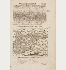
The title on verso is surrounded by a beautiful woodcut border. From Sebastian Münster & Claudius Ptolemy's Geographiae Claudii Ptolemaei Alexandrini, published 1552 by Henricus Petri in Basel.
Details
| Cartographer | Sebastian Münster |
| Title | Landtafel des Ungerlands, Polands, Reussen, Littaw, Walachei, Bulgarei |
| Publisher, Year | Heinrich Petri, Basle, 1540 (1552) |
| Plate Size | 29.0 x 37.0 cm (11.4 x 14.6 inches) |
| Sheet Size | 30.7 x 38.5 cm (12.1 x 15.2 inches) |
Condition
Cartographer
Images to Download
If you like to download the image of this map with a resolution of 1200 pixels, please follow the link below.
You can use this image for publication on your personal or commercial websites for free if you set a link to this website. If you need photographs with a higher resolution, please contact us.
Poland - Münster, Sebastian - Landtafel des Ungerlands, Polands,...






![Aldenburg [Aldenbvrg] Aldenburg [Aldenbvrg]](https://www.vintage-maps.com/2177-home_default/muenster-germany-lower-saxony-stade-1574.jpg)
