Product successfully added to your shopping cart
There are 0 items in your cart. There is 1 item in your cart.
Total products
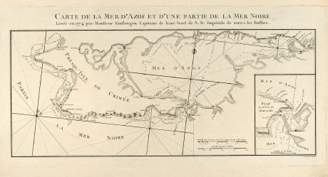
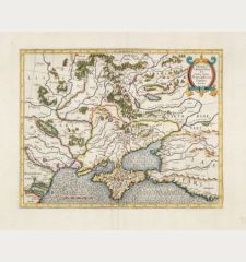
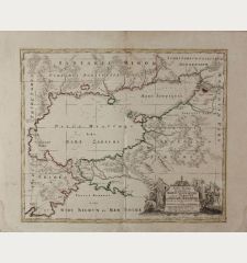
Carte de la Mer d'Azof et d'une Partie de la Mer Noire
Pierre François Tardieu (*1711 - †1774)Antique map of the Sea of Azov, Black Sea, Crimea. Printed in Paris in the year 1783.
Reference 10514
Description
Engraved map of the Crimean Peninsula with the Black Sea and the Sea of Azov in Russia. From the Atlas Volume of "Histoire physique, morale, civile et politique de la Russie Ancienne" by N. G. Le Clerc. Engraved by P. F. Tardieu.
Details
| Cartographer | Pierre François Tardieu |
| Title | Carte de la Mer d'Azof et d'une Partie de la Mer Noire |
| Publisher, Year | Paris, 1783 |
| Plate Size | 23.7 x 48.0 cm (9.3 x 18.9 inches) |
| Sheet Size | 31.9 x 51.5 cm (12.6 x 20.3 inches) |
Condition
Excellent conditions.
Cartographer
Pierre François Tardieu was a French engraver born 1711 in Paris. He died 1774.
Images to Download
If you like to download the image of this map with a resolution of 1200 pixels, please follow the link below.
You can use this image for publication on your personal or commercial websites for free if you set a link to this website. If you need photographs with a higher resolution, please contact us.
Pierre François Tardieu: Carte de la Mer d'Azof et d'une Partie de la Mer Noire.
Antique map of the Sea of Azov, Black Sea, Crimea. Printed in Paris in the year 1783.
Russia - Tardieu, Pierre François - Carte de la Mer d'Azof et d'une Partie de...

![Verus Chersonesi Tauricae Seu Crimea Conspectus ... [and] Theatrum Belli Ao MDCCXXXVII ... [and] Explicatio Duarum Tabularum... Verus Chersonesi Tauricae Seu Crimea Conspectus ... [and] Theatrum Belli Ao MDCCXXXVII ... [and] Explicatio Duarum Tabularum...](https://www.vintage-maps.com/2205-home_default/du-chaffat-ukraine-russo-turkish-war-crimea-1740.jpg)
