Product successfully added to your shopping cart
There are 0 items in your cart. There is 1 item in your cart.
Total products
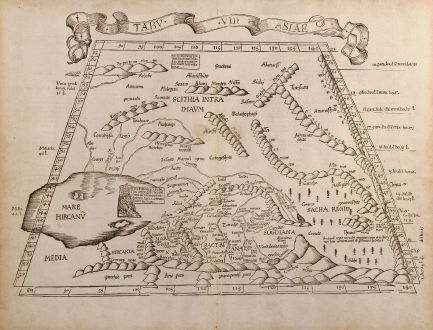
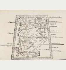
Tabu. VII Asiae
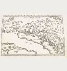
Laurent Fries (*1485 - †1532)Antique woodcut map of the Caspian Sea. Printed in Strasbourg by Grüninger in 1525.
Reference 10081
Description
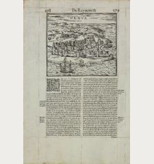
Trapezoidal Ptolemaic woodcut map showing the area around Caspian Sea. A reduced version of Martin Waldseemullers ptolemy map from 1513. From the 1525 Strassbourg Edition of Ptolemy's Geographia. Verso: Text surrounded by woodcut decorations and a city prospect.
Details
| Cartographer | Laurent Fries |
| Title | Tabu. VII Asiae |
| Publisher, Year | Grüninger, Strasbourg, 1525 |
| Plate Size | 32.0 x 46.0 cm (12.6 x 18.1 inches) |
Condition
Good strong impression. Several tiny tears in margin, flatted and tears in centerfold professional restored. Some browning in margin. Overall very good condition.
Cartographer
Laurent Fries was a French physician and mathematician born around 1485 in Mulhouse. He settled finally in Strassburg where he meat Peter Apian and the publisher Johannes Grüninger which made him interested in the Ptolemy Atlas of 1513 and 1520. Fries made new woodcut maps in reduced size. His Ptolemy Atlas was published first in 1522, reissued in 1525, 1535 and 1541. He died in 1532.
Images to Download
If you like to download the image of this map with a resolution of 1200 pixels, please follow the link below.
You can use this image for publication on your personal or commercial websites for free if you set a link to this website. If you need photographs with a higher resolution, please contact us.
Laurent Fries: Tabu. VII Asiae.
Antique woodcut map of the Caspian Sea. Printed in Strasbourg by Grüninger in 1525.


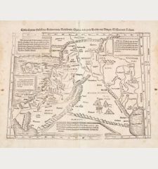
![[Die Tafel gibt ein klein anzeigung...] [Die Tafel gibt ein klein anzeigung...]](https://www.vintage-maps.com/1544-home_default/muenster-holy-land-israel-cyprus-1574.jpg)


![Tabula nova Hispaniae [Tabula noua Hispaniae] Tabula nova Hispaniae [Tabula noua Hispaniae]](https://www.vintage-maps.com/3236-home_default/fries-spain-portugal-1541.jpg)
![[De Boemia. / Tabula quarta & quinta Europae de nonnullis / Germaniae ...] [De Boemia. / Tabula quarta & quinta Europae de nonnullis / Germaniae ...]](https://www.vintage-maps.com/2304-home_default/fries-germany-1541.jpg)
![[Tab. Mo. Primae Partis Aphricae et Tabula Secunde partis Aphricae.] [Tab. Mo. Primae Partis Aphricae et Tabula Secunde partis Aphricae.]](https://www.vintage-maps.com/3651-home_default/fries-north-africa-1525.jpg)
