Product successfully added to your shopping cart
There are 0 items in your cart. There is 1 item in your cart.
Total products

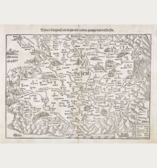
Helvetiae moderna descriptio
Sebastian Münster (*1489 - †1552)Coloured woodcut map of Switzerland. Printed in Basle circa 1550.
Reference 10942
Description
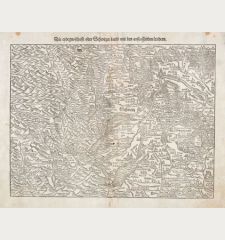
Early woodcut map showing Switzerland, South Germany and the Lake Constance. From a Latin edition of Cosmographia from Sebastian Munster, published around 1550.
Details
| Cartographer | Sebastian Münster |
| Title | Helvetiae moderna descriptio |
| Publisher, Year | Basle, circa 1550 |
| Plate Size | 26.7 x 34.0 cm (10.5 x 13.4 inches) |
| Sheet Size | 31.8 x 41.0 cm (12.5 x 16.1 inches) |
Condition
Two small wormholes close to centrefold back. Very good conditions.
Cartographer
Sebastian Münster was born 1489 in Ingelheim (Pfalz). First being a Franciscan, he became Professor for Theology, Hebrew and Mathematics after he converted to Protestantism in 1529. He became one of the most influencing geographers of the sixteenth century. His Cosmographia, published in 1544, spread geographical knowledge wide over Europe. It was issued in nearly 40 editions and 6 languages. Münster was the first cartographer publishing each known continent on a separate map. His second important work was the Geographia, a new edition of Ptolemys Geographia. He died May 1552 in Basel on Black Death.
Images to Download
If you like to download the image of this map with a resolution of 1200 pixels, please follow the link below.
You can use this image for publication on your personal or commercial websites for free if you set a link to this website. If you need photographs with a higher resolution, please contact us.
Sebastian Münster: Helvetiae moderna descriptio.
Coloured woodcut map of Switzerland. Printed in Basle circa 1550.
Switzerland - Münster, Sebastian - Helvetiae moderna descriptio


![[Nova Helvetiae tabula geographica] [Nova Helvetiae tabula geographica]](https://www.vintage-maps.com/3425-home_default/scheuchzer-switzerland-lake-geneva-1720.jpg)

![[ohne Titel] [ohne Titel]](https://www.vintage-maps.com/1915-home_default/muenster-switzerland-fribourg-freiburg-im-ueechtland-1574.jpg)
![[Neuwnburger See] [Neuwnburger See]](https://www.vintage-maps.com/1642-home_default/muenster-switzerland-lake-neuchatel-lac-de-neuchatel-1574.jpg)
![Aldenburg [Aldenbvrg] Aldenburg [Aldenbvrg]](https://www.vintage-maps.com/2177-home_default/muenster-germany-lower-saxony-stade-1574.jpg)
