Schleswig-Holstein
- 1
- 2
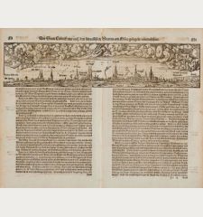
Die Statt Lübeck, eine auff den fürnemsten Stetten am More gelegen, contrafehtet.
Heinrich Petri, Basle, 1574
Large, early woodcut view of Lübeck by Sebastian Munster on the full double sheet. Title and a description of the city on verso. From the German edition of Sebastian Munster's Cosmography, titled...
Die Statt Lübeck, eine auff den fürnemsten Stetten am More gelegen,...
1574 - Sebastian Münster
11596Antique woodcut town view of Lübeck, Schleswig-Holstein. Printed in Basle by Heinrich Petri in 1574.
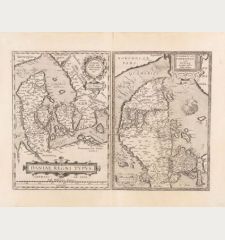
120,00 €Daniae regni typus / Cimbricae Chersonesi nunc Iutiae
Jan Baptist Vrients, Antwerp, 1602
Antique map of Denmark by A. Ortelius. Two maps on one sheet. The left map shows the entire Kingdom of Denmark with Schleswig-Holstein and the Baltic coast of Mecklenburg-Vorpommern in the south....
Daniae regni typus / Cimbricae Chersonesi nunc Iutiae
1602 - Abraham Ortelius
12763Antique map of Denmark. Printed in Antwerp by Jan Baptist Vrients in 1602.
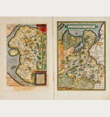
590,00 €Oldenburg Comit. / Thietmarsiae, Holsaticae Regionis Partis Typus
A. Ortelius, Antwerp, 1603
Old coloured antique map of Oldenburg country and Dithmarschen by A. Ortelius. Two maps on one sheet. The right map shows the Oldenburg country between Weser and East Friesland from Bremen to Jever...
Oldenburg Comit. / Thietmarsiae, Holsaticae Regionis Partis Typus
1603 - Abraham Ortelius
11856Old coloured map of Schleswig-Holstein, Lower Saxony. Printed in Antwerp by A. Ortelius in 1603.
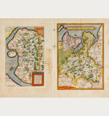
490,00 €Oldenburg Comit. / Thietmarsiae, Holsaticae Regionis Partis Typus
A. Ortelius, Antwerp, 1609-41
Old coloured antique map of Oldenburg country and Dithmarschen by A. Ortelius. Two maps on one sheet. The right map shows the Oldenburg country between Weser and East Friesland from Bremen to Jever...
Oldenburg Comit. / Thietmarsiae, Holsaticae Regionis Partis Typus
1609 - Abraham Ortelius
11847Old coloured map of Schleswig-Holstein, Lower Saxony. Printed in Antwerp by A. Ortelius in 1609.
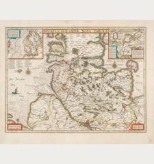
450,00 €Ducatus Holsatiae nova tabula
H. Hondius, Amsterdam, 1633
Beautiful antique map of Holstein by H. Hondius. Below the Elbe from its mouth to Hamburg. The historical landscapes are highlighted by colouring: Wagiren from the Kiel Fjord to the Bay of Lübeck,...
Ducatus Holsatiae nova tabula
1633 - Jodocus Hondius
12827Coloured map of Schleswig-Holstein, Germany. Printed in Amsterdam by H. Hondius in 1633.
490,00 €Pascaart vande Noort-Zee. Tabula Hydrographica Oceani Borealis.
Johannes Janssonius, Amsterdam, 1650
Rare and very decorative, old coloured sea chart of the North Sea by J. Janssonius. Shows the North Sea coast with the Shetland and Orkney Islands, the Scottish and English east coast, Calais and...
Pascaart vande Noort-Zee. Tabula Hydrographica Oceani Borealis.
1650 - Johannes Janssonius
11914Old coloured sea chart of the North Sea. Printed in Amsterdam by Johannes Janssonius in 1650.
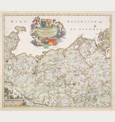
1 650,00 €Ducatus Meklenburgicus in quo sunt Ducatus Vandaliae et Meklenburgi Ducatus et Comitatus Swerinensis
F. de Wit, Amsterdam, circa 1680
Old coloured antique map of Mecklenburg-Vorpommern by Frederick de Wit. Showing the Baltic coast from Holstein with Fehmarn, Travemünde and Lübeck via Wismar and Rostock to Rügen. In the south the...
Ducatus Meklenburgicus in quo sunt Ducatus Vandaliae et Meklenburgi...
1680 - Frederick de Wit
12509Old coloured map of Mecklenburg-Vorpommern, Germany. Printed in Amsterdam by F. de Wit circa 1680.
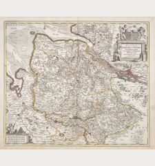
450,00 €Ducatus Bremae & Ferdae maximaeque partis fluminis Visurgis
Covens & Mortier, Amsterdam, circa 1720
Old coloured antique map of the Duchy of Bremen by Frederick de Wit. Shows the area between Hamburg and Bremen, the mouth of the Elbe and Weser. With Bremerhaven, Oldenburg and Verden. A beautiful...
Ducatus Bremae & Ferdae maximaeque partis fluminis Visurgis
1720 - Frederick de Wit
12514Old coloured map of Lower Saxony, Germany. Printed in Amsterdam by Covens & Mortier circa 1720.
450,00 €Ducatus Luneburgici et Dannebergensis Comitatus Nova Descriptio
Covens & Mortier, Amsterdam, circa 1720
Old coloured antique map of Niedersachsen (Lower Saxony) by Frederick de Wit. Shows the Elbe River from Hamburg to Schnackenburg. With Lüneburg, Lauenburg, Danneberg, Hanover, Brunswick, Wolfsburg,...
Ducatus Luneburgici et Dannebergensis Comitatus Nova Descriptio
1720 - Frederick de Wit
12515Old coloured map of Lower Saxony, Germany. Printed in Amsterdam by Covens & Mortier circa 1720.
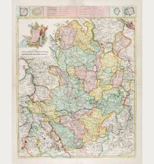
450,00 €La Westphalie ...
G.L. le Rouge, Paris, 1742
Large antique map of the northwestern part of Germany by le Rouge after Homann and Hübner. Showing the coastline between the mouth of the Rhine and the Elbe in the north and the course of the Rhine...
La Westphalie ...
1742 - George Louis le Rouge
12665Coloured map of North Rhine-Westphalia, Germany. Printed in Paris by G.L. le Rouge in 1742.
320,00 €Lubeca
Anton Koberger, Nuremberg, 1493
Incunabulum leaf in folio showing the Hanseatic City of Lubeck in Schleswig-Holstein by H. Schedel from the famous "Nuremberg Chronicle" in Latin edition printed 1493. Verso the right half of...
Lubeca
1493 - Hartmann Schedel
10952Antique woodcut town view of Lubeck. Printed in Nuremberg by Anton Koberger in 1493.
SoldHassiae Descriptio, Ioanne Drynadro Auctore / Holsatiae Descrip.
A. Ortelius, Antwerp, 1579
Old coloured antique map of Schleswig-Holstein and Hesse by A. Ortelius. Two maps on a sheet. The right map shows Schleswig-Holstein between the Elbe river and Flensburg and from the North Sea to...
Hassiae Descriptio, Ioanne Drynadro Auctore / Holsatiae Descrip.
1579 - Abraham Ortelius
11857Old coloured map of Schleswig-Holstein, Hesse. Printed in Antwerp by A. Ortelius in 1579.
SoldDanorum Marca, vel Cimbricum, aut Daniae regnum...
Gottfried von Kempen, Cologne, 1585 [1588]
Gorgeous, old coloured map of Denmark by M. Jordanus from the town book Civitates orbis terrarum by Braun and Hogenberg. Showing Denmark with Holstein and Zealand with Bornholm in the east....
Danorum Marca, vel Cimbricum, aut Daniae regnum...
1585 - Braun & Hogenberg
12141Old coloured map of Denmark. Printed in Cologne by Gottfried von Kempen in 1588.
SoldDanorum Marca, vel Cimbricum, aut Daniae regnum...
Gottfried von Kempen, Cologne, 1585 [1588]
Gorgeous coloured map of Denmark by M. Jordanus from the town book Civitates orbis terrarum by Braun and Hogenberg. Showing Denmark with Holstein and Zealand with Bornholm in the east. Decorated...
Danorum Marca, vel Cimbricum, aut Daniae regnum...
1585 - Braun & Hogenberg
12650Coloured map of Denmark. Printed in Cologne by Gottfried von Kempen in 1588.
SoldLubeca, Lvbeck [Lübeck], Luneburgum, Lüneburg
N. Basse, Frankfurt, 1595
Rare antique town view of Lübeck, Schleswig-Holstein. On verso the city view of Lüneburg, Lower Saxony. From the town book Parvum Theatrum Urbium by Abraham Saur. First published 1595 by N. Basse.
Lubeca, Lvbeck [Lübeck], Luneburgum, Lüneburg
1595 - Abraham Saur
12339Antique woodcut town view of Lüneburg, Lübeck, Schleswig-Holstein. Printed in Frankfurt by N. Basse in 1595.
SoldSaxonum regionis quatenus eius gentis imperium nomenque olim patebat, recens germanaque delineatio
J. Bussemacher, Cologne, circa 1600
Antique map of Northern Germany by Matthias Quad. Shows Westphalia, Lower Saxony, Schleswig-Holstein, Mecklenburg-Vorpommern, Saxony-Anhalt and Brandenburg. In the east parts of Poland. Below left...
Saxonum regionis quatenus eius gentis imperium nomenque olim patebat,...
1600 - Matthias Quad
11834Coloured map of Northern Germany. Printed in Cologne by J. Bussemacher circa 1600.
SoldThietmarsiae Holsaticae regionis partis typus Auctore Petro Boeckel
J. Bussemacher, Cologne, circa 1600
Antique map of Dithmarschen, Schleswig-Holstein by Matthias Quad. Shows Dithmarschen between the North Sea, Eider and Elbe. From Brunsbüttel to St. Annen, with Heide and Hemmingstedt in the centre....
Thietmarsiae Holsaticae regionis partis typus Auctore Petro Boeckel
1600 - Matthias Quad
12389Old coloured map of Dithmarschen, Schleswig-Holstein. Printed in Cologne by J. Bussemacher circa 1600.
SoldSaxonum regionis quatenus eius gentis imperium nomenque olim patebat, recens germanaque delineatio
J. Bussemacher, Cologne, circa 1600
Antique map of Northern Germany by Matthias Quad. Shows Westphalia, Lower Saxony, Schleswig-Holstein, Mecklenburg-Vorpommern, Saxony-Anhalt and Brandenburg. In the east parts of Poland. With the...
Saxonum regionis quatenus eius gentis imperium nomenque olim patebat,...
1600 - Matthias Quad
12402Coloured map of Northern Germany. Printed in Cologne by J. Bussemacher circa 1600.
SoldHolsatiae Descripto
A. Ortelius, Antwerp, 1612
Original handcoloured map of Holstein by Abraham Ortelius. From the italian edition of "Theatrum Orbis Terrarum" from 1612. Cartographic source is a map of Holstein from Mark Jorden which was...
Holsatiae Descripto
1612 - Abraham Ortelius
10302Coloured map of Holstein. Printed in Antwerp by A. Ortelius in 1612.
SoldDaniae Regnu
J. Hondius, Amsterdam, 1613-19
Old coloured antique map of Denmark by Gerard Mercator. Shows Denmark with Holstein and Mecklenburg with Rügen in the south and south Sweden in the north. Top right a title cartouche, in the North...
Daniae Regnu
1613 - Gerard Mercator
11863Old coloured map of Denmark. Printed in Amsterdam by J. Hondius in 1613.
SoldCeleberrimi Fluvii Albis nova delineatio. Auctore Christiano Mollero.
J. Blaeu, Amsterdam, 1628 [circa 1640]
Very decorative map of the Elbe between Hamburg and the North Sea by W. Blaeu. Showing the Lower Elbe from Geesthacht to the mouth of the Elbe into the North Sea. The fairway is marked with buoys....
Celeberrimi Fluvii Albis nova delineatio. Auctore Christiano Mollero.
1628 - Willem Janszoon Blaeu
12669Coloured map of the course of the Elbe River. Printed in Amsterdam by J. Blaeu 1628 [circa 1640].
SoldTotius Circuli Westphalici Accurata descriptio Amstelodami Sumptibus Henrici Hondy
H. Hondius, Amsterdam, circa 1630
West oriented copper engraved map of Lower Saxony with Friesland by H. Hondius. Showing the coastal line between the river mouth of Rhine and Elbe and down to Cologne in the South. With one figural...
Totius Circuli Westphalici Accurata descriptio Amstelodami Sumptibus...
1630 - Jodocus Hondius
10956Antique map of Friesland, Lower Saxony. Printed in Amsterdam by H. Hondius circa 1630.
SoldEpiscopatus Bremensis cum Adiacentibus
Amsterdam, circa 1630
Decorative copper engraved map of Lower Saxony centred around Bremen by G. Mercator. Showing the area between the river Ems and Elbe along the North Sea coast with the East Frisian Islands. With...
Episcopatus Bremensis cum Adiacentibus
1630 - Gerard Mercator
10962Antique map of Bremen, Lower Saxony. Printed in Amsterdam circa 1630.
SoldDaniae Regnu
H. Hondius, Amsterdam, 1633
Beautiful coloured antique map of Denmark by Gerard Mercator. Shows Denmark with Holstein and Mecklenburg with Rügen in the south and south Sweden in the north. Top right a title cartouche, in the...
Daniae Regnu
1633 - Gerard Mercator
12833Coloured map of Denmark. Printed in Amsterdam by H. Hondius in 1633.
Sold
- 1
- 2





![Braun & Hogenberg: Danorum Marca, vel Cimbricum, aut Daniae regnum... Braun & Hogenberg, Denmark, 1585 [1588]: Danorum Marca, vel Cimbricum, aut Daniae regnum...](https://www.vintage-maps.com/2851-home_default/braun-hogenberg-denmark-1585-1588.jpg)
![Braun & Hogenberg: Danorum Marca, vel Cimbricum, aut Daniae regnum... Braun & Hogenberg, Denmark, 1585 [1588]: Danorum Marca, vel Cimbricum, aut Daniae regnum...](https://www.vintage-maps.com/3838-home_default/braun-hogenberg-denmark-1585-1588.jpg)
![Abraham Saur: Lubeca, Lvbeck [Lübeck], Luneburgum, Lüneburg Saur, Germany, Schleswig-Holstein, Lübeck, Lüneburg, 1595: Lubeca, Lvbeck [Lübeck], Luneburgum, Lüneburg](https://www.vintage-maps.com/3153-home_default/saur-germany-schleswig-holstein-luebeck-lueneburg-1595.jpg)


![Willem Janszoon Blaeu: Celeberrimi Fluvii Albis nova delineatio. Auctore Christiano Mollero. Blaeu, Hamburg, Course of Elbe River, 1628 [ 1640]: Celeberrimi Fluvii Albis nova delineatio. Auctore Christiano Mollero.](https://www.vintage-maps.com/3815-home_default/blaeu-hamburg-course-of-elbe-river-1628--1640.jpg)


