Product successfully added to your shopping cart
There are 0 items in your cart. There is 1 item in your cart.
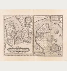
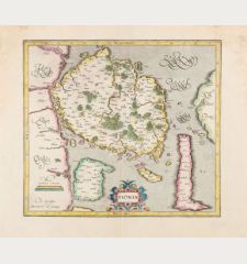
Danorum Marca, vel Cimbricum, aut Daniae regnum...
Braun & HogenbergReference 12141
Description
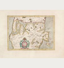
Gorgeous, old coloured map of Denmark by M. Jordanus from the town book Civitates orbis terrarum by Braun and Hogenberg. Showing Denmark with Holstein and Zealand with Bornholm in the east. Decorated with three cartouches, the coat of arms of Denmark, two whales and a sailing boat. This is the first state. Later the date M.D.LXXXV. in the lower title cartouche was removed.
Dreyer-E., Geschichte, p. 102:
The oldest printed general map of Denmark.
This map is the only map that was bound into the town book of Braun and Hogenberg.
Details
| Cartographer | Braun & Hogenberg |
| Title | Danorum Marca, vel Cimbricum, aut Daniae regnum... |
| Publisher, Year | Gottfried von Kempen, Cologne, 1585 [1588] |
| Plate Size | 38.5 x 46.5 cm (15.2 x 18.3 inches) |
| Sheet Size | 41.5 x 58.0 cm (16.3 x 22.8 inches) |
| Reference | Van der Krogt, P.: Koeman's Atlantes Neerlandici, 4986.1 |
Condition
Cartographer
Images to Download
If you like to download the image of this map with a resolution of 1200 pixels, please follow the link below.
You can use this image for publication on your personal or commercial websites for free if you set a link to this website. If you need photographs with a higher resolution, please contact us.
Denmark - Braun & Hogenberg - Danorum Marca, vel Cimbricum, aut Daniae...

![Braun & Hogenberg: Danorum Marca, vel Cimbricum, aut Daniae regnum... Antique Maps, Braun & Hogenberg, Denmark, 1585 [1588]: Danorum Marca, vel Cimbricum, aut Daniae regnum...](https://www.vintage-maps.com/2851-large_default/braun-hogenberg-denmark-1585-1588.jpg)
