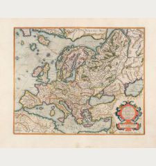
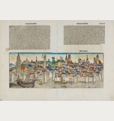
[Germania Magna]
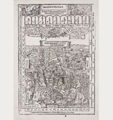
Hartmann Schedel (*1440 - †1514)Antique woodcut map of the European continent. Printed in Nuremberg by Anton Koberger in 1493.
Reference 11306
Description
The first modern map of northern and central Europe
Second printed map of the North, after the woodcut map published in the Ulm Ptolemy edition of 1482/86. First issue, with Latin text colophon and date on verso. The map is also deemed to be the first printed map of Germany, even if it shows a larger area.
W. B. Grinsberg characterized this map as the first modern map of northern and central Europe. The map ranges from the British Isles to Constantinople. The designer has been identified as Hieronymus Münzer (1437-1508), who trained as a physician... The Münzer map is one of the earliest to depict the Scandinavia peninsula...
Nordenskold credits the map of the north in the Zamoyski codes as the prototype for this map. The source for the central European portion is a manuscript map of 1460 of Germany by Cardinal Nicolas Cusanus (also Nicholas of Cusa), printed posthumously at Eichstätt in 1491.
The woodblock cutter was Michael Wolgemut, the well-known teacher of Albrecht Dürer. Wohlgemut was Albrecht Dürer's tutor between 1486-90. Since the young Dürer was active in Wohlgemut's printer shop during the time the woodblock for the Nuremberg Chronicle have produced, he may also have collaborated, since some of the cuts bear a remarkably close resemblance to his Apocalypse illustrations.
Details
| Cartographer | Hartmann Schedel |
| Title | [Germania Magna] |
| Publisher, Year | Anton Koberger, Nuremberg, 1493 |
| Plate Size | 38.5 x 57.8 cm (15.2 x 22.8 inches) |
| Sheet Size | 40.3 x 58.5 cm (15.9 x 23.0 inches) |
| Reference | Ginsberg, W.B. (Scandinavia) #2; Campbell, T. (The Earliest Printed Maps: 1472-1500) #220. |
Condition
Overall slightly wavy and wrinkled, two vertical creases, several worm traces in lower part restored, upper half of the centrefold restored and redrawn between one and two cm width, several tears in margin, some with paper loss, restored. Partly reinforced on verso.
Cartographer
Hartmann Schedel was born 1440 in Nuremberg. He studied in Leipzig and Padua several disciplines also Physics, Medicine and Laws. Neither his social position nor his business made him famous, but his major work the so called Schedel's World Chronicle. The incunable was issued 1493 in Latin, followed by the German edition in the same year. It contains more than 1800 woodcuts out of Michael Wolgemut woodcut shop. Albrecht Dürer completed an apprenticeship with Wolgemut around 1490, so even Dürer may has worked on these woodcuts. Many of the illustrations showing cities the first time ever. In 1497 the Small Schedel was printed by Johann Schönsperger in Augsburg, a reduced version of the Nuremberg print also smaller in size. Schedel died 1514 in Nuremberg.
Images to Download
If you like to download the image of this map with a resolution of 1200 pixels, please follow the link below.
You can use this image for publication on your personal or commercial websites for free if you set a link to this website. If you need photographs with a higher resolution, please contact us.
Hartmann Schedel: [Germania Magna].
Antique woodcut map of the European continent. Printed in Nuremberg by Anton Koberger in 1493.

![Hartmann Schedel: [Germania Magna] Antique Maps, Schedel, Europe Continent, 1493: [Germania Magna]](https://www.vintage-maps.com/1528-large_default/schedel-europe-continent-1493.jpg)

![[Map of Europe] [Map of Europe]](https://www.vintage-maps.com/2931-home_default/bordone-europe-continent-1528-1565.jpg)
