Product successfully added to your shopping cart
There are 0 items in your cart. There is 1 item in your cart.
Total products
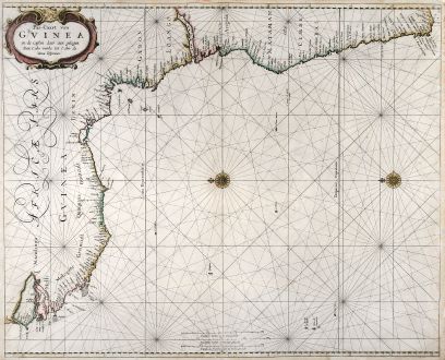
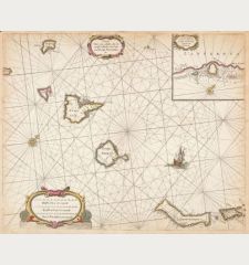
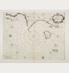
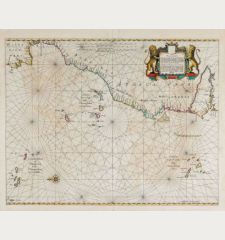
Pas-Caart van Guinea en de Custen daer aen gelegen Van Cabo verde tot Cabo de Bona...
Pieter Goos (*1615 - †1675)Sea chart of the southwest coast of Africa by Pieter Goos. Published in Amsterdam in 1666.
Reference 10411
Description
Beautiful sea chart of the southwest coast of Africa by P. Goos from the famous sea atlas "De Zee-Atlas ofte Water-Weereld". Showing the coatlines of Guinea, Sierra Leone, Liberia, Ivory Coast via Namibia down to Cape Town.
Details
| Cartographer | Pieter Goos |
| Title | Pas-Caart van Guinea en de Custen daer aen gelegen Van Cabo verde tot Cabo de Bona Esperanca |
| Publisher, Year | Amsterdam, 1666 |
| Plate Size | 54.5 x 44.2 cm (21.5 x 17.4 inches) |
| Sheet Size | 56.0 x 45.5 cm (22.0 x 17.9 inches) |
| Reference | Burden 389; Koeman IV, 23 |
Condition
Some small tears in margin backed. Very good condition.
Cartographer
Pieter Goos, the son of Abraham Goos, was born 1615. He continued his father's successful business and became a famous engraver of sea charts. Pieter Goos' marine atlases were held to be among the finest printed at the time and were often added to the nine or twelve volumes of Blaeu's Atlas Maior. (Shirley). He died in 1675.
Images to Download
If you like to download the image of this map with a resolution of 1200 pixels, please follow the link below.
You can use this image for publication on your personal or commercial websites for free if you set a link to this website. If you need photographs with a higher resolution, please contact us.
Pieter Goos: Pas-Caart van Guinea en de Custen daer aen gelegen Van Cabo verde tot Cabo de Bona Esperanca.
Sea chart of the southwest coast of Africa by Pieter Goos. Published in Amsterdam in 1666.
Africa - Goos, Pieter - Pas-Caart van Guinea en de Custen daer aen...

![[Tab. Mo. Primae Partis Aphricae et Tabula Secunde partis Aphricae.] [Tab. Mo. Primae Partis Aphricae et Tabula Secunde partis Aphricae.]](https://www.vintage-maps.com/3651-home_default/fries-north-africa-1525.jpg)
![[Nile River delta] [Nile River delta]](https://www.vintage-maps.com/2049-home_default/muenster-egypt-nile-river-1574.jpg)
