Product successfully added to your shopping cart
There are 0 items in your cart. There is 1 item in your cart.
Total products
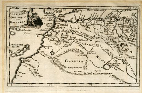
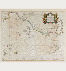
Mauritana et Africa Propria nunc Barbaria
Phillip Clüver (*1580 - †1622)Antique map of North-Western Africa. Printed circa 1700.
Reference 10783
Description
Nice engraved map of the north-western part of Africa with the Canary Islands by Phillip Clüver. With one cartouch.
Details
| Cartographer | Phillip Clüver |
| Title | Mauritana et Africa Propria nunc Barbaria |
| Publisher, Year | circa 1700 |
| Plate Size | 12.8 x 21.2 cm (5.0 x 8.3 inches) |
| Sheet Size | 16.0 x 24.0 cm (6.3 x 9.4 inches) |
Condition
Minor browning in margin and a small hole in magin.
Cartographer
Phillip Cluver was a German geograph and historian. He studied law in Leiden. After travelling a lot, he finally settled in Leiden in 1615 where he received a regular pension from the University. His main publications: Germania Antiqua (1616), Siciliae Antiquae libri duo (1619), Sardinia et Corsica Antiqua (1619), Italia Antiqua (1624, posthumous), Introductio in Universam Geographiam (1629).
Images to Download
If you like to download the image of this map with a resolution of 1200 pixels, please follow the link below.
You can use this image for publication on your personal or commercial websites for free if you set a link to this website. If you need photographs with a higher resolution, please contact us.
Phillip Clüver: Mauritana et Africa Propria nunc Barbaria.
Antique map of North-Western Africa. Printed circa 1700.
Africa - Clüver, Phillip - Mauritana et Africa Propria nunc Barbaria

![[Tab. Mo. Primae Partis Aphricae et Tabula Secunde partis Aphricae.] [Tab. Mo. Primae Partis Aphricae et Tabula Secunde partis Aphricae.]](https://www.vintage-maps.com/3651-home_default/fries-north-africa-1525.jpg)
![[Nile River delta] [Nile River delta]](https://www.vintage-maps.com/2049-home_default/muenster-egypt-nile-river-1574.jpg)
