Product successfully added to your shopping cart
There are 0 items in your cart. There is 1 item in your cart.
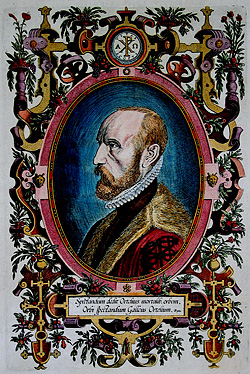
Antique Maps by Abraham Ortelius (*1527 - †1598)

Regni Hispaniae Post Omnium Editiones Locuplettissima Descriptio
Plantin Press, Antwerp, 1598
Antique map of Spain and Portugal by A. Ortelius. Showing the Iberian Peninsula with Balearic Islands and parts of northern Africa. With one large cartouche, a mileage scale, sailing ships and sea...
Regni Hispaniae Post Omnium Editiones Locuplettissima Descriptio
1598 - Abraham Ortelius
12092Coloured map of Spain - Portugal. Printed in Antwerp by Plantin Press in 1598.
Sold
Typus Orbis Terrarum
Plantin Press, Antwerp, 1598
An old coloured and early example of one of the most famous world maps ever published. From the first modern atlas Theatrum Orbis Terrarum by Abraham Ortelius. "As the first world map occurring...
Typus Orbis Terrarum
1598 - Abraham Ortelius
12786Antique map of the world by Abraham Ortelius. Published in 1598 in Antwerp.
Sold
Angliae, Scotiae et Hiberniae, sive Britannicar: Insularum Descriptio.
Antwerp, 1601
Beautiful original old coloured copper engraved map of the British Isles by A. Ortelius. Decorated with five sailing ships, two cartouches, a mileage scale and coat of arms. From the 1601 Latin...
Angliae, Scotiae et Hiberniae, sive Britannicar: Insularum Descriptio.
1601 - Abraham Ortelius
11335Old coloured map of the United Kingdom. Printed in Antwerp in the year 1601.
Sold
Scotiae Tabula
Antwerp, 1602
Original old coloured map of Scotland by A. Ortelius. With one large cartouche, one sailing ship and a sea monster. From the 1602 German edition of "Theatrum Orbis Terrarum". Based on Mercator's...
Scotiae Tabula
1602 - Abraham Ortelius
10879Old coloured map of Scotland. Printed in Antwerp in the year 1602.
Sold
Africae Tabula Nova
Antwerp, 1603
Beautiful hand coloured map of the African continent. From the 1603 Latin edition of Theatrum Orbis Terrarum by Abraham Ortelius. Fifth state of the copperplate, still the date 1570 is present in...
Africae Tabula Nova
1603 - Abraham Ortelius
10656Coloured map of the African continent. Printed in Antwerp in the year 1603.
Sold
Pontus Euxinus
Antwerp, 1603
Detailed engraved map of the Black Sea by Abraham Ortelius. Covering the Black Sea with Ukraine, Crimea, and the surrounding countries. With two Renaissance cartouches. From the Latin edition of 1603.
Pontus Euxinus
1603 - Abraham Ortelius
10856Antique map of the Crimea, Ukraine, Black Sea. Printed in Antwerp in the year 1603.
Sold
Lutzenburgensis Ducatus veriss. descript. Iacobo Surhonio Montano auctore.
Antwerp, 1603
Decorative map of Luxembourg by A. Ortelius. With a two nice Renaissance cartouches and a mileage scale. From the 1603 Latin edition of 'Theatrum Orbis Terrarum'.
Lutzenburgensis Ducatus veriss. descript. Iacobo Surhonio Montano auctore.
1603 - Abraham Ortelius
10872Antique map of Luxembourg. Printed in Antwerp in the year 1603.
Sold
Saxoniae, Misniae, Thuringiae, Nova Exactissimaq. Descriptio
Antwerp, 1603
Old coloured antique map of Saxony and Thuringia by Abraham Ortelius. Shows the area between Berlin and Braunschweig in the north, to Prague in the south and Silesia in the east. With Chemnitz,...
Saxoniae, Misniae, Thuringiae, Nova Exactissimaq. Descriptio
1603 - Abraham Ortelius
11842Old coloured map of Saxony, Saxony-Anhalt, Thuringia. Printed in Antwerp in the year 1603.
Sold
Buchaviae, sive Fuldensis Ditionis Typus / Waldeccensis Comitatus Descriptio Accuratissima
A. Ortelius, Antwerp, 1603
Old coloured antique map of Hesse by A. Ortelius. Two maps on one sheet. The right map shows the country Waldeck between Frankenberg (Eder) and Warburg. With Korbach and Waldeck in the centre....
Buchaviae, sive Fuldensis Ditionis Typus / Waldeccensis Comitatus...
1603 - Abraham Ortelius
11854Old coloured map of Fulda, Waldeck, Hesse. Printed in Antwerp by A. Ortelius in 1603.
Sold
Westphaliae Totius, Finitimarumque Regionum Accurata Descriptio
A. Ortelius, Antwerp, 1603
Antique map of North Rhine-Westphalia and Lower Saxony by Abraham Ortelius. In the north with East Frisia, Oldenburg and Bremen, in the south to Duisburg, Dusseldorf and Cologne. Osnabrück is...
Westphaliae Totius, Finitimarumque Regionum Accurata Descriptio
1603 - Abraham Ortelius
11855Coloured map of North Rhine-Westphalia, Lower Saxony. Printed in Antwerp by A. Ortelius in 1603.
Sold
Germaniae Veteris, Typus.
A. Ortelius, Antwerp, 1603
Old coloured, antique map of Germany and the central part of Europe during the classical antiquity by Abraham Ortelius. With Germany, the Netherlands, Austria and parts of Switzerland, Poland and...
Germaniae Veteris, Typus.
1603 - Abraham Ortelius
11859Old coloured map of Germany. Printed in Antwerp by A. Ortelius in 1603.
Sold
Presbiteri Iohannis, sive, Abissinorum Imperii Descriptio
Jan Baptist Vrients, Antwerp, 1603
Hand coloured antique map of Africa by Abraham Ortelius. Shows the Kingdom of the mystical Prester John in central Africa. Decorated with two cartouches, four elephants, sea monsters and a sailing...
Presbiteri Iohannis, sive, Abissinorum Imperii Descriptio
1603 - Abraham Ortelius
11900Coloured map of Priest Joan, Ethiopia, Central Africa. Printed in Antwerp by Jan Baptist Vrients in 1603.
Sold
Cypri Insulae Nova Descript. 1573
Jan Baptist Vrients, Antwerp, 1603
Early and important map of Cyprus by Abraham Ortelius. The geographical details are based on the map of Cyprus by Giacomo Franco from 1570. Below right a inset map of Lemnos, based on notes by...
Cypri Insulae Nova Descript. 1573
1603 - Abraham Ortelius
11921Coloured map of Cyprus. Printed in Antwerp by Jan Baptist Vrients in 1603.
Sold
Lutzenburgen sis Ducatus Veriss. Descript. Iacobo Surhonio Montano auctore.
Jan Baptist Vrients, Antwerp, 1603
Antique map of Luxembourg by Abraham Ortelius. In the east the Moselle from Metz to Trier, in the west the Meuse with Namur and Charleville-Mézières. Decorated with two beautiful cartouches. First...
Lutzenburgen sis Ducatus Veriss. Descript. Iacobo Surhonio Montano auctore.
1603 - Abraham Ortelius
11922Old coloured map of Luxembourg. Printed in Antwerp by Jan Baptist Vrients in 1603.
Sold
Anglia regnum si quod aliud in toto Oceano ditissimum et florentissimum
J. B. Vrients, Antwerp, 1603
Rare and very decorative map of England and Wales after the map of England by Christopher Saxton from 1579. Commissioned by Jacob Vrients and engraved by Pieter van den Keere, probably the finest...
Anglia regnum si quod aliud in toto Oceano ditissimum et florentissimum
1603 - Abraham Ortelius
12136Coloured map of England, Wales. Printed in Antwerp by J. B. Vrients in 1603.
Sold
Ausszug auss des Abrahami Ortelij Theatro Orbis teutsch beschriben durch Levinum Hulsium,...
Levinus Hulsius, Jan van Keerbergen, Frankfurt, 1604
Very Rare and Only German Edition of the Pocket Atlas by Ortelius. With 128 Maps.Complete and well preserved example of the rare German edition of Ortelius's Epitome. Edited by Levinus...
Ausszug auss des Abrahami Ortelij Theatro Orbis teutsch beschriben durch...
1604 - Abraham Ortelius
12590Pocket atlas by Ortelius with 128 copper engraved maps, publihed by L. Hulsius and J. van Keerbergen 1604 in Frankfurt.
Sold
Mansfeldiae Comitatus Descriptio Auctore, Tilemanno Stella Sig.
A. Ortelius, Antwerp, 1606
Old colored antique map of Saxony-Anhalt by A. Ortelius. Shows the area between Halle a. d. Saale, Aschersleben, Walkenried and Heldrungen with Mansfeld in the centre. Top right a title cartouche....
Mansfeldiae Comitatus Descriptio Auctore, Tilemanno Stella Sig.
1606 - Abraham Ortelius
11867Old coloured map of Mansfeld, Saxony-Anhalt. Printed in Antwerp by A. Ortelius in 1606.
Sold
Irlandiae Accurata Descriptio, Auctore Baptista Boazio
J. B. Vrients, Antwerp, 1608 or 1612
Rare and incredible decorative map of Ireland with beautiful old colour. This west-oriented map rarely appears on the market, since it was bound in only a few copies of the Ortelius Atlas, while...
Irlandiae Accurata Descriptio, Auctore Baptista Boazio
1608 - Abraham Ortelius
11476One of the most desirable map of Ireland for collectors. Based on the map of Boazio, published by J. B. Vrients in Antwerp between 1608 and 1612.
Sold
Brandenburgensis Marchae Descriptio
Antwerp, 1608 or 1612
Old coloured antique map of Brandenburg by Abraham Ortelius. Shows Brandenburg with parts of Mecklenburg-Western Pomerania and Poland. From Ueckermünde and Szczecin to Wittenberg and Cottbus. In...
Brandenburgensis Marchae Descriptio
1608 - Abraham Ortelius
11841Old coloured map of Berlin, Brandenburg. Printed in Antwerp in 1608 or 1612.
Sold
Cataloniae principatus novissima et accurata descriptio
J. B. Vrients, Antwerp, 1608 or 1612
Rare and very decorative map of Catalonia (Catalunya) by J. B. Vrients. Commissioned by Jacob Baptiste Vrients and engraved by Pieter van den Keere, probably the finest engraver of his time....
Cataloniae principatus novissima et accurata descriptio
1608 - Abraham Ortelius
12413Old coloured map of Catalonia, Cataluna, Catalunya. Printed in Antwerp by J. B. Vrients in 1608 or 1612.
Sold
Pannoniae, et Illyrici Veteris Tabula
Jan Baptist Vrients, Antwerp, 1608 or 1612
Old coloured antique map of the Western Balkans by Abraham Ortelius. Shows Croatia, Slovenia, Bosnia and Herzegovina with the Adriatic Sea. With three beautiful cartouches. From the Italian edition...
Pannoniae, et Illyrici Veteris Tabula
1608 - Abraham Ortelius
12479Old coloured map of Croatia, Adriatic Sea, Western Balkans. Printed in Antwerp by Jan Baptist Vrients in 1608 or 1612.
Sold
Scotiae Tabula
Antwerp, 1609
Beautiful original coloured map of Scotland. From the 1609 Latin edition of "Theatrum Orbis Terrarum" by Abraham Ortelius. Second state of the copperplate. The cartographical source of this map...
Scotiae Tabula
1609 - Abraham Ortelius
10143Old coloured map of Scotland. Printed in Antwerp in the year 1609.
Sold Descriptio / Monasteriensis et Osnaburgensis Episcopatus Descriptio")
Franciae Orientalis (vulgo Franckenlant) Descriptio / Monasteriensis et Osnaburgensis Episcopatus...
A. Ortelius, Antwerp, 1609-41
Antique map of Franconia and the Münsterland by A. Ortelius. Two maps on one sheet. The right map shows the Münsterland with parts of Lower Saxony between Oldenburg and the Lippe river. In the west...
Franciae Orientalis (vulgo Franckenlant) Descriptio / Monasteriensis et...
1609 - Abraham Ortelius
11848Antique map of Franconia, Bavaria, North Rhine-Westphalia. Printed in Antwerp by A. Ortelius in 1609.
Sold
Lacus Lemani Vicinorumq. Locorum Nova et Accurata Descriptio
J. B. Vrients, Antwerp, 1609 or 1612
Rare and extremely decorative map of Lake Geneva by J. B. Vrients. Vrients used this map only in 3 editions of the Ortelius atlases he published between 1608 and 1612. According to Marcel Van den...
Lacus Lemani Vicinorumq. Locorum Nova et Accurata Descriptio
1609 - Abraham Ortelius
12646Old coloured map of the Lac Leman, Lake Geneva. Printed in Antwerp by J. B. Vrients in 1609 or 1612.
Sold


 Descriptio / Monasteriensis et Osnaburgensis Episcopatus Descriptio")
