Product successfully added to your shopping cart
There are 0 items in your cart. There is 1 item in your cart.
Total products
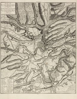
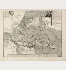
Plan de Luxembourg de ses Nouvelles Fortifications et de ses Environs.
Covens and MortierAntique map of Luxembourg. Printed in Amsterdam by Covens & Mortier in 1745.
Reference 11054
Description
A large, scarce of Luxembourg by Covens & Mortier. Based on an earlier Jaillot map. Including a key showing 41 place names. Printed on heavy paper.
Details
| Cartographer | Covens and Mortier |
| Title | Plan de Luxembourg de ses Nouvelles Fortifications et de ses Environs. |
| Publisher, Year | Covens & Mortier, Amsterdam, 1745 |
| Plate Size | 65.5 x 55.0 cm (25.8 x 21.7 inches) |
| Sheet Size | 73.0 x 56.0 cm (28.7 x 22.0 inches) |
Condition
Strong and clear impression, evidence of old folding, very good conditions.
Cartographer
Pieter und David Mortier were booksellers in Paris and have published a wide range of geographical works. After Pieter's death, his widow continued the business until their son Cornelius took over. Cornelius started a partnership with his brother-in-law Johannes Covens and established the famous publishing house Covens and Mortier in Amsterdam. They have re-issued Atlases of Sanson, de l'Isle, Visscher and de Wit.
Images to Download
If you like to download the image of this map with a resolution of 1200 pixels, please follow the link below.
You can use this image for publication on your personal or commercial websites for free if you set a link to this website. If you need photographs with a higher resolution, please contact us.
Covens and Mortier: Plan de Luxembourg de ses Nouvelles Fortifications et de ses Environs..
Antique map of Luxembourg. Printed in Amsterdam by Covens & Mortier in 1745.
Luxembourg - Covens and Mortier - Plan de Luxembourg de ses Nouvelles...

