Menu
- Antique Maps
- Atlases
- Globes
- Cartographers
- Aa, Pieter van der
- Adams, John
- Adrichem, Christian
- Albizzi, Antonio
- Allard, Carel
- Allard, Hugo
- Altmannshausen, Johann Ernst von
- Angelocrator, Daniel
- Anguissola, Leander
- Anonymous
- Bachmann, John
- Bailleul le Jeune, Nicolas
- Barbault, Jean
- Bayer, Johann
- Beaurain, Jean de
- Beek, Anna
- Belleforest, Francois de
- Bellin, Jacques Nicolas
- Bellus, Nicolaus
- Bertius, Petrus
- Bibliographisches Institut
- Bickham, George
- Blaeu, Joan
- Blaeu, Willem Janszoon
- Bodenehr, Gabriel
- Bodmer, Karl
- Boethius, Christoph
- Bonifacio, Natal
- Bonne, Rigobert
- Bordone, Benedetto
- Borgia, Stefano
- Botero, Giovanni
- Bowen, Emanuel
- Bowles and Carver
- Bowles, Thomas
- Braun & Hogenberg
- Breydenbach, Bernhard von
- Brion de la Tour, Louis
- British Admiralty
- Bry, Theodor de
- Bucelin, Gabriel
- Buffon, G.-L. Leclerc de
- Bünting, Heinrich
- Bussemacher, Johann
- Call, Pieter van
- Camocio, Giovanni Francesco
- Caoursin, Guillaume
- Cary, John
- Cellarius, Andreas
- Celtis, Konrad
- Chaffat, Antoine du
- Chapman and Hall
- Clouet, Jean Baptiste Louis
- Clüver, Phillip
- Collins, Greenville
- Coronelli, Vincenzo Maria
- Covens and Mortier
- Curtis, William
- d'Anville, Jean Baptiste
- Danckerts, Justus
- Danckerts, Theodorus
- de l'Isle, Guillaume
- De Pierre
- Delamarche, Charles Francois
- Deroy, Isidore Laurent
- Doncker, Hendrick
- Doppelmayr, Johann Gabriel
- Downing, Alexander
- Drummond, Alexander
- Dudley, Robert
- Duflos, Claude
- Edwards, Sydenham Teak
- Ellis, Joseph
- Elwe, Jan Barend
- Euler, Leonhard
- Faden, William
- Fer, Nicolas de
- Flinders, Matthew
- Fouquet, Pieter
- Fourdrinier, Pierre
- Fricx, Eugene Henri
- Fries, Laurent
- Garden, Francis
- Geographisches Institut Weimar
- Goos, Abraham
- Goos, Pieter
- Greenwood, Christopher
- Haffner, Johann Christoph
- Haupt, Gottfried Jacob
- Holle, Lienhart
- Homann Erben
- Homann, Johann Baptist
- Homann, Johann Christoph
- Hondius, Jodocus
- Hondt, Pieter de
- Hooker, William
- Husson, Pierre
- Jaillot, Alexis Hubert
- Janssonius, Johannes
- Jefferys, Thomas
- Jode, Gerard de
- Johnston, Alexander Keith
- Jombert, Charles Antoine
- Jonston, John
- Julien, Roch Joseph
- Keere, Pieter van den
- Keulen, Johannes van
- Kilian, Georg Christoph
- Kip, William
- Kitchin, Thomas
- Langlois, Hyacinthe
- Laurie & Whittle
- le Clerc, Nicolas Gabriel
- le Rouge, George Louis
- Lempriere, Clement
- Lespinasse, Nicolas Louis de
- Lesson, René Primevère
- Linschoten, Jan Huygen van
- Little, William
- Loots, Johannes
- Lotter, Tobias Conrad
- Magini, Giovanni Antonio
- Magnus, Olaus
- Mallet, Alain Manesson
- Mann, Fred & Helen
- Mannevillette, Jean Baptiste
- Mariette, Jean
- Mayer, Tobias
- Medina, Pedro de
- Megenberg, Konrad von
- Meissner, Daniel
- Mejer, Johannes
- Mercator, Gerard
- Mercator, Michael
- Mercator, Rumold
- Merian, Maria Sibylla
- Merian, Matthäus
- Middiman, Samuel
- Montanus, Arnoldus
- Morden, Robert
- Mortier, David
- Mortier, Pieter
- Mosley, Charles
- Mount & Page
- Münster, Sebastian
- Mynde, James
- Nolin, Jean Baptiste
- Noort, Olivier van
- Norden, Frederick Louis
- Ortelius, Abraham
- Ottens, Reiner
- Owen & Bowen
- Peck, Francis
- Pigeot, Francois
- Pitt, Moses
- Pluche, Noel Antoine
- Poggibonsi, Niccolo da
- Porcacchi, Tomaso
- Porro, Girolamo
- Ptolemaeus, Claudius
- Pufendorf, Samuel Baron von
- Quad, Matthias
- Raigniauld, Henry
- Ramusio, Giovanni Battista
- Rastrick, Gulielmus
- Regnault, Nicolas François
- Reilly, Franz Johann Joseph von
- Renard, Louis
- Riemer, Jacob de
- Robert de Vaugondy, Gilles
- Robert, Nicolas
- Rocque, Barthélemy de La
- Rocque, John
- Rossetti, Domenico
- Rossi, Giovanni Giacomo
- Roy, Bernard de
- Ruscelli, Girolamo
- Russell, John
- Sanson, Nicolas
- Saur, Abraham
- Schedel, Hartmann
- Schenk, Pieter
- Scheuchzer, Johann Jakob
- Schindelmayer, Carl Robert
- Schley, Jakob van der
- Schmidt, Johann Friedrich Julius
- Schotanus van Sterringa, Bernhard
- Schreiber, Johann Georg
- Schwabe, Johann Joachim
- Seale, Richard William
- Seller, John
- Seutter, George Matthäus
- Shaw, Thomas
- Smallegange, Mattheus
- Smith, Charles
- Speed, John
- Stampioen, Jan Janszoon
- Stieler, Adolf
- Stockdale, John
- Stöcklein, Joseph
- Stoopendaal, Daniel
- Sylvanus, Bernardus
- Tallis, John
- Tardieu, Pierre François
- Thornton, John
- Tirinus, Jacobus
- Tirion, Isaak
- Toms, William Henry
- Ughi, Lodovico
- Valegio, Francesco
- Valk & Schenk
- Valk, Gerard
- Verneau, Charles
- Vidal y Pinilla, Felipe
- Visscher, Nicolas
- Waghenaer, Lucas Janszoon
- Waldseemüller, Martin
- Weigel, Christoph
- Weis, Franz Joseph
- Wells, Edward
- Whitbread, Josiah
- Wit, Frederick de
- Wytfliet, Cornelius
- Zenoi, Domenico
- Zoutman, Jan Dirksz
- Graphics
- New Additions
Cart
0 Product: Products: (empty)
No products
Product successfully added to your shopping cart
There are 0 items in your cart. There is 1 item in your cart.
Total products
Continue shopping Proceed to checkout
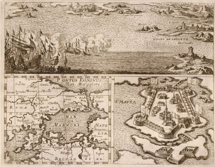
Golfo de Lepante, Mar de Marmora, S. Maura
AnonymousDescription
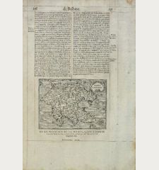
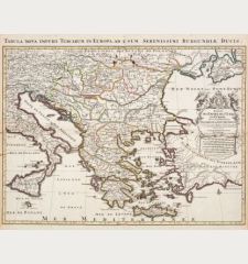
Beautiful cooper engraved sheet with two vies and one map. The large view showing a sea battle between the Peloponnese and Lefkada, the smaller view showing the fortification of Lefkada (St. Maura) and the map is about the Bosporus with Constantinople and parts of Greece and Turkey.
Details
| Cartographer | Anonymous |
| Title | Golfo de Lepante, Mar de Marmora, S. Maura |
| Publisher, Year | circa 1700 |
| Plate Size | 22.0 x 28.0 cm (8.7 x 11.0 inches) |
| Sheet Size | 23.0 x 29.5 cm (9.1 x 11.6 inches) |
Condition
Excellent condition.
Images to Download
If you like to download the image of this map with a resolution of 1200 pixels, please follow the link below.
You can use this image for publication on your personal or commercial websites for free if you set a link to this website. If you need photographs with a higher resolution, please contact us.
Anonymous: Golfo de Lepante, Mar de Marmora, S. Maura.
Antique map of St. Maura, Lefkada, Peloponnese. Printed circa 1700.
Greece - Anonymous - Golfo de Lepante, Mar de Marmora, S. Maura

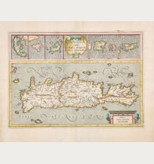
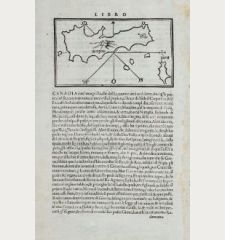
![[Candia, Crete, Karpathos] [Candia, Crete, Karpathos]](https://www.vintage-maps.com/2939-home_default/bordone-greece-crete-and-karpathos-1528-1565.jpg)
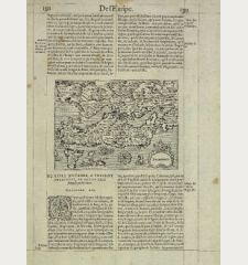
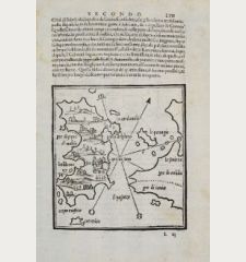
![[Euboea, Negroponte, Bosporus, Istanbul] [Euboea, Negroponte, Bosporus, Istanbul]](https://www.vintage-maps.com/2937-home_default/bordone-greece-negroponte-euboea-1528-1565.jpg)
![Ch'onha chido [Atlas of all under Heaven] Ch'onha chido [Atlas of all under Heaven]](https://www.vintage-maps.com/3314-home_default/anonymous-korean-woodblock-atlas-chonha-chido-1750.jpg)
![Ch'onha Chido [Atlas of all under Heaven] Ch'onha Chido [Atlas of all under Heaven]](https://www.vintage-maps.com/3336-home_default/anonymous-korean-manuscript-atlas-chonha-chido-1820.jpg)
![Ch'onha Chido [Atlas of all under Heaven] Ch'onha Chido [Atlas of all under Heaven]](https://www.vintage-maps.com/4291-home_default/anonymous-korean-manuscript-atlas-chonha-chido-1800.jpg)
