Product successfully added to your shopping cart
There are 0 items in your cart. There is 1 item in your cart.
Total products
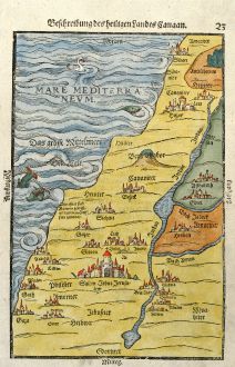
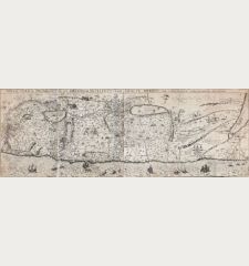
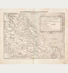
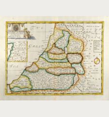
Beschreibung des heiligen Landes Canaan
Heinrich Bünting (*1545 - †1606)Coloured woodcut map of Israel, Palestine. Printed in Magdeburg by A. Duncker in 1581.
Reference 10840
Description
Decorative coloured uncommon woodcut map of Palestine / Israel from "Itinerarium Sacrae Scripturae" by Heinrich Bunting. His work was much valued after the first edition in 1581, mainly because of its emblematic maps, which show the world arranged in the form of a clover leaf with Jerusalem at the centre, Europe in the form of a Queen and Asia in the form of Pegasus. Also this map with the Jordan river in form of a snake could have emblematic relevance. German text on verso.
Details
| Cartographer | Heinrich Bünting |
| Title | Beschreibung des heiligen Landes Canaan |
| Publisher, Year | A. Duncker, Magdeburg, 1581 |
| Plate Size | 26.5 x 17.3 cm (10.4 x 6.8 inches) |
| Sheet Size | 31.5 x 19.8 cm (12.4 x 7.8 inches) |
| Reference | Laor 140, Loewenhardt 23 |
Condition
Some wormholes in top left white margin restored. Very good conditions.
Cartographer
Heinrich Bünting was a protestant Theologian and Chronicler. His main work Itinerarium sacrae scripturae first published 1581, was much valued, mainly because of its emblematic maps, which show the world arranged in the form of a clover leaf with Jerusalem at the centre, Europe in the form of a Queen and Asia in the form of Pegasus.
Images to Download
If you like to download the image of this map with a resolution of 1200 pixels, please follow the link below.
You can use this image for publication on your personal or commercial websites for free if you set a link to this website. If you need photographs with a higher resolution, please contact us.
Heinrich Bünting: Beschreibung des heiligen Landes Canaan.
Coloured woodcut map of Israel, Palestine. Printed in Magdeburg by A. Duncker in 1581.
Holy Land - Bünting, Heinrich - Beschreibung des heiligen Landes Canaan

![[Die Tafel gibt ein klein anzeigung...] [Die Tafel gibt ein klein anzeigung...]](https://www.vintage-maps.com/1544-home_default/muenster-holy-land-israel-cyprus-1574.jpg)

![[Nile River delta] [Nile River delta]](https://www.vintage-maps.com/2049-home_default/muenster-egypt-nile-river-1574.jpg)
