Product successfully added to your shopping cart
There are 0 items in your cart. There is 1 item in your cart.
Americae sive Novi Orbis, Nova Descriptio / Die newen Inseln, so hinder Hispania gegen...
Sebastian Münster (*1489 - †1552)Reference 12430
Description
Beautiful original antique map of America by Sebastian Münster. The west coast of North America features Vázquez de Coronado's Quivira, one of the mythical Seven Cities of Gold, as well as the Sierra Nevada. There are also many interesting place names on the east coast.
Philip D. Burden notes about this map of America by Münster:
The geography of the American map particularly had become very out of date. To replace it he [the publisher: Sebastian Petri] relied upon the earlier copperplate map of America by Abraham Ortelius of 1570; it is virtually identical and bears no relation to the earlier Münster. Clearly when the block was cut they had not had access to Ortelius' third plate of 1587 in which he removed the southern bulge to the Chilean coastline. The familiar Ortelian westem coastline of North America and the large unknown southern continent also appear. There were not many editions after this, just 1592, 1598, 1614 and in 1628.
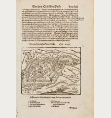
On verso the title with a woodcut element. From the German edition of Sebastian Munster's Cosmography, titled Cosmographey oder beschreibung aller Länder, published 1598 by S. Petri in Basel. The woodblock of this map was first used in Münster's cosmography of 1588.
Details
| Cartographer | Sebastian Münster |
| Title | Americae sive Novi Orbis, Nova Descriptio / Die newen Inseln, so hinder Hispania gegen Orient, bey dem Landt Indie gelegen |
| Publisher, Year | Sebastian Petri, Basle, 1588 (1598) |
| Plate Size | 32.0 x 36.1 cm (12.6 x 14.2 inches) |
| Sheet Size | 33.7 x 40.7 cm (13.3 x 16.0 inches) |
| Reference | Burden, P.D.: The Mapping of North America No. 67 |
Condition
Cartographer
Images to Download
If you like to download the image of this map with a resolution of 1200 pixels, please follow the link below.
You can use this image for publication on your personal or commercial websites for free if you set a link to this website. If you need photographs with a higher resolution, please contact us.
America Continent - Münster, Sebastian - Americae sive Novi Orbis, Nova Descriptio...


![Aldenburg [Aldenbvrg] Aldenburg [Aldenbvrg]](https://www.vintage-maps.com/2177-home_default/muenster-germany-lower-saxony-stade-1574.jpg)
