Product successfully added to your shopping cart
There are 0 items in your cart. There is 1 item in your cart.
Total products
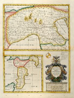
A New Map of Gallia Cisalpina & Graecia Magna ...
Edward Wells (*1667 - †1727)Coloured map of Sicily, South Italy, North Italy. Printed in London by E. Wells circa 1738.
Reference 10831
Description
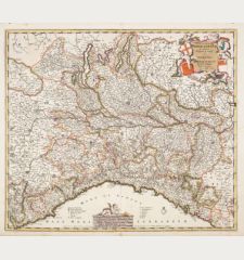
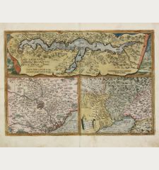
Decorative coloured map of Northern Italy in the upper part and beneath this South Italy with parts of Sicily.
From "A New Sett of Maps both of Antient and Present Geography" by Edward Wells an English clergyman, teacher and mathematician, born in 1667. All map are dedicated to William the Duke of Gloucester who died 1700, the year of the first edition of the atlas. The Wells maps have been much valued during the beginning of the 18th century because of its accuracy.
From "A New Sett of Maps both of Antient and Present Geography" by Edward Wells an English clergyman, teacher and mathematician, born in 1667. All map are dedicated to William the Duke of Gloucester who died 1700, the year of the first edition of the atlas. The Wells maps have been much valued during the beginning of the 18th century because of its accuracy.
Details
| Cartographer | Edward Wells |
| Title | A New Map of Gallia Cisalpina & Graecia Magna ... |
| Publisher, Year | E. Wells, London, circa 1738 |
| Plate Size | 47.7 x 36.0 cm (18.8 x 14.2 inches) |
| Sheet Size | 54.0 x 42.0 cm (21.3 x 16.5 inches) |
Condition
Minor browning in right margin around centrefold. Manuscript page number by old hand in upper right margin. Excellent condition.
Cartographer
Edward Wells, born in 1667, was a British teacher and mathematician how issued A New Sett of Maps dedicated to William the Duke of Gloucester in 1700. He died in 1727.
Images to Download
If you like to download the image of this map with a resolution of 1200 pixels, please follow the link below.
You can use this image for publication on your personal or commercial websites for free if you set a link to this website. If you need photographs with a higher resolution, please contact us.
Edward Wells: A New Map of Gallia Cisalpina & Graecia Magna ....
Coloured map of Sicily, South Italy, North Italy. Printed in London by E. Wells circa 1738.
Italy - Wells, Edward - A New Map of Gallia Cisalpina & Graecia...




![[Sardigna, Sardinia, Sardegna] [Sardigna, Sardinia, Sardegna]](https://www.vintage-maps.com/2947-home_default/bordone-italy-sardinia-sardegna-1528-1565.jpg)
