North Africa
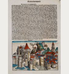
Damiata
Anton Koberger, Nuremberg, 1493
Early woodcut view of Damiette (Dumyat) in Egypt by Hartmann Schedel. On verso a view of ancient Corinth in Greece. From the famous Liber Chronicarum also known as the Nuremberg Chronicle ,...
Damiata
1493 - Hartmann Schedel
12108Coloured woodcut town view of Dumyat, Damietta. Printed in Nuremberg by Anton Koberger in 1493.
SoldCarthago
Anton Koberger, Nuremberg, 1493
Early woodcut view of Carthage in Tunisia near Tunis by Hartmann Schedel. From the famous Liber Chronicarum also known as the Nuremberg Chronicle , printed in 1493. Leaf number XL.The...
Carthago
1493 - Hartmann Schedel
12114Coloured woodcut town view of Carthage, Tunis, Tunisia. Printed in Nuremberg by Anton Koberger in 1493.
SoldMemphis vel Chairum
Anton Koberger, Nuremberg, 1493
Early woodcut view of Cairo, Egypt by Hartmann Schedel. To the left a woodcut of Abraham. From the famous Liber Chronicarum also known as the Nuremberg Chronicle , printed in 1493. Leaf number...
Memphis vel Chairum
1493 - Hartmann Schedel
12125Coloured woodcut town view of Cairo. Printed in Nuremberg by Anton Koberger in 1493.
SoldTertia Africae Tabula
Johannes Schott, Strasbourg, 1513 or 1520
Early woodcut map of North Africa from M. Waldseemuller of 1513 (1520). Showing the region from Bengazi in Libya up to Egypt with the Red Sea.This ptolemaic map comes from the first so called...
Tertia Africae Tabula
1513 - Martin Waldseemüller
11144Antique woodcut map of the Red Sea, Egypt, Libya, North Africa. Printed in Strasbourg by Johannes Schott in 1513 or 1520.
Sold[Madeira and Canary Islands]
Venice, 1528-1565
Rare map of Madeira by Benedetto Bordone. On verso a map of the Canary Islands with the coast of Africa. Two woodcut maps on one sheet.From Libro di Benedetto Bordone... de tutte l'isole del...
[Madeira and Canary Islands]
1528 - Benedetto Bordone
12241Antique woodcut map of Madeira, Canary Islands. Printed in Venice between 1528 and 1565.
SoldAphricae tabula secunda continet
Trechsel, Vienne, 1541
Untitled trapezoidal Ptolemaic woodcut map of North Africa. From the 1541 Vienne (Dauphiné) edition of Ptolemy's Geographia published by Gaspar Trechsel and sold by Hughes de la Porte in Lyon. The...
Aphricae tabula secunda continet
1541 - Laurent Fries
10111Coloured woodcut map of Sardinia, Malta, North Africa. Printed in Vienne by Trechsel in 1541.
Sold[Nile River delta] / Bacchus
Heinrich Petri, Basle, 1550
Early woodcut map of the Nile River delta by Sebastian Münster. Shows the Mediterranean coast with parts of the Gulf of Suez. With Alexandria in the West, Cairo with the Pyramids of Giza in the...
[Nile River delta] / Bacchus
1550 - Sebastian Münster
12597Antique woodcut map of the Nile River. Printed in Basle by Heinrich Petri in 1550.
SoldWarhaffte abcontrafehtung der Mechtigen und Vesten Statt Alkair
Heinrich Petri, Basle, 1574
Early woodcut view of Cairo in Egypt by Sebastian Münster. Showing the city from a birdeye perspective with the Pyramids of Giza, the Great Sphinx of Giza, crocodiles and ships in the Nile River....
Warhaffte abcontrafehtung der Mechtigen und Vesten Statt Alkair
1574 - Sebastian Münster
11683Antique woodcut town view of Cairo. Printed in Basle by Heinrich Petri in 1574.
Sold[Tunis]
Heinrich Petri, Basle, 1574
Beautiful coloured view of Tunis in Tunisia by Sebastian Münster. Shows the zoological and botanical garden, castle Goleta, a Harem and a Thermae. From the German edition of Sebastian Münster's...
[Tunis]
1574 - Sebastian Münster
11692Coloured woodcut map of Tunis, Tunisia. Printed in Basle by Heinrich Petri in 1574.
SoldTunes Urbs
Cologne, 1575
Attractive cityview of Tunis in Tunisia / Africa. Showing the Imperial attack on Tunis in 1573. Latin text on verso.
Tunes Urbs
1575 - Braun & Hogenberg
10017Antique town view of Tunis. Printed in Cologne in the year 1575.
SoldWarhaffte abcontrafehtung der machtigen und vesten Statt Alkair
Petri, Basle, circa 1575
Woodcut view of Cairo in Egypt by Sebastian Münster. From a German edition of the "Cosmographey". Showing the city from birdeye perspective with the Pyramids, the Great Sphinx of Giza, crocodiles...
Warhaffte abcontrafehtung der machtigen und vesten Statt Alkair
1575 - Sebastian Münster
10393Coloured woodcut town view of Cairo, Egypt. Printed in Basle by Petri circa 1575.
SoldSepta
Nicolas Chesneau, Michel Sonnius, Paris, 1575
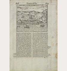
A scarce and early woodcut view of Ceuta, north-western Africa, belonging to Spain. Ruled in brown ink. As a woodcut view, it is extremely fine cut. On the full text sheet. Based on the Ceuta view...
Septa
1575 - Francois de Belleforest
11420Antique woodcut town view of Ceuta. Printed in Paris by Nicolas Chesneau, Michel Sonnius in 1575.
SoldCairus Quae Olim Babylon Aegypti Maxima Urbs
Cologne, circa 1580
Attractive birdeye view of Cairo in Egypt with the Nile river, the Great Pyramids and Sphinx of Giza. Beautiful original colour. German text on verso. From a German edition of "Civitates orbis...
Cairus Quae Olim Babylon Aegypti Maxima Urbs
1580 - Braun & Hogenberg
10146Old coloured town view of Giza, Cairo, Egypt. Printed in Cologne circa 1580.
SoldAlgier
Petri, Basle, circa 1580
Woodcut cityview of Algier / Algeria / North Africa. From a German edition of Cosmographia by Sebastian Munster printed from Petri in Basel.
Algier
1580 - Sebastian Münster
10132Antique woodcut town view of Algier. Printed in Basle by Petri circa 1580.
SoldTunis
Petri, Basle, circa 1580
Woodcut cityview of Tunis / Tunisia / North Africa including zoological and botanical garden, castle Goleta, a Harem and a Thermae. From a German edition of Cosmographia by Sebastian Munster...
Tunis
1580 - Sebastian Münster
10131Antique woodcut town view of Tunis. Printed in Basle by Petri circa 1580.
SoldFezzae et Marocchi regna Africae celeberrima
W. Blaeu, Amsterdam, circa 1640
Old coloured engraved map of Morocco by W. Blaeu. With the Strait of Gibraltar, several sailing ships and a large figural cartouche. The map is based on Ortelius map of 1570. From 'Atlas Major'...
Fezzae et Marocchi regna Africae celeberrima
1640 - Willem Janszoon Blaeu
10864Old coloured map of Morocco. Printed in Amsterdam by W. Blaeu circa 1640.
SoldAlgier
M. Merian, Frankfurt, 1646
Attractive birdeye view of Algiers in Algeria from Matthäus Merian. Showing the city with city walls, outlying forts and several ships in the harbour. From J. Gottfried's "Neuwe Archontologia...
Algier
1646 - Matthäus Merian
10595Antique town view of Algiers. Printed in Frankfurt by M. Merian in 1646.
SoldAbris der Vestung Tripoli in Barbarien
M. Merian, Frankfurt, 1646
Interesting engraving of the fort of Tripoli in Libya from Matthäus Merian. Showing details of the fort with an 29 key index.
Abris der Vestung Tripoli in Barbarien
1646 - Matthäus Merian
10597Antique town view of Tripoli, Libya. Printed in Frankfurt by M. Merian in 1646.
SoldAbbildung der Statt Gigeri in affrica, wie solche der König in Franckreich durch den Hertzogen de...
M. Merian, Frankfurt, 1646
Attractive engraving of the Jijel (Djidjelli) in North-west Algeria from Matthäus Merian. Showing the city with several ships and the Atlas Mountains in background. With an index from a to h and a...
Abbildung der Statt Gigeri in affrica, wie solche der König in...
1646 - Matthäus Merian
10598Antique town view of Jijel, Algeria. Printed in Frankfurt by M. Merian in 1646.
SoldTunes
Merian, Frankfurt, 1646
Engraved cityview of Tunis the Capital of Tunisia in North Africa including zoological and botanical gardens. From J. Gottfried's "Neuwe Archontologia Cosmica".
Tunes
1646 - Matthäus Merian
10612Antique town view of Tunisia, Tunis. Printed in Frankfurt by Merian in 1646.
SoldGeographische Beschryvinghe Van de Wandeling Der Apostelen ende De Reysen Pauli...
Paulus Aertsz van Ravesteyn, Amsterdam, 1654
Very decorative map of the Eastern Mediterranean by Nicolas Visscher from 1654. From Italy to the Holy Land, Iraq and up to the Red Sea. With Sicily, Malta and Cyprus. Shows the travel of St. Paul...
Geographische Beschryvinghe Van de Wandeling Der Apostelen ende De...
1654 - Nicolas Visscher
12739Old map of the Eastern Mediterranean Sea. Printed in Amsterdam by Paulus Aertsz van Ravesteyn in 1654.
SoldNieuwe verbeterde Pascaart Beginnende van het Canaal en so Langs de kusten van Spanjen, en...
Johannes Loots, Amsterdam, circa 1700
Very rare nautical chart of the north-eastern Atlantic by Johannes Loots. Shows the coastline from Southern Ireland, Cornwall, Brittany, Spain, Portugal and the northwest coast of Africa to Cape...
Nieuwe verbeterde Pascaart Beginnende van het Canaal en so Langs de...
1700 - Johannes Loots
12616Sea chart of the Atlantic Ocean. Printed in Amsterdam by Johannes Loots circa 1700.
SoldNouvelle carte reduite de la Mediterranee - Nieuwe Wassende Graadege Pas-kaart van de Geheele...
Johannes Loots, Amsterdam, 1715
Very rare nautical chart of the Mediterranean Sea by Johannes Loots. Above the western part of the Mediterranean with the coasts of Spain, France, Italy, the Balkans and the northwestern part of...
Nouvelle carte reduite de la Mediterranee - Nieuwe Wassende Graadege...
1715 - Johannes Loots
12615Sea chart of the Mediterranean Sea. Printed in Amsterdam by Johannes Loots in 1715.
SoldAfricae Pars Superior Occidentalis
Johann Ernst Adelbulner, Nuremberg, 1718
Antique map of Northwest Africa with the Canary Islands by Christoph Weigel. Showing the northwest coast of Africa, in the south to Cap-Vert (Capo Verde) near Dakar. With the Senegal, Morocco,...
Africae Pars Superior Occidentalis
1718 - Christoph Weigel
11961Old coloured map of Northwest Africa with Canary Islands. Printed in Nuremberg by Johann Ernst Adelbulner in 1718.
Sold


![Benedetto Bordone: [Madeira and Canary Islands] Bordone, Spain - Portugal, Canary Islands, Madeira, 1528-1565: [Madeira and Canary Islands]](https://www.vintage-maps.com/3023-home_default/bordone-spain-portugal-canary-islands-madeira-1528-1565.jpg)

![Sebastian Münster: [Nile River delta] / Bacchus Münster, Egypt, Nile River, 1550: [Nile River delta] / Bacchus](https://www.vintage-maps.com/3705-home_default/muenster-egypt-nile-river-1550.jpg)

![Sebastian Münster: [Tunis] Münster, North Africa, Tunisia, Tunis, 1574: [Tunis]](https://www.vintage-maps.com/2072-home_default/muenster-north-africa-tunisia-tunis-1574.jpg)


