Product successfully added to your shopping cart
There are 0 items in your cart. There is 1 item in your cart.
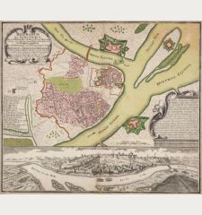
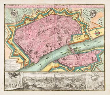
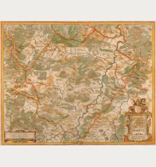
Franckfurt am Mayn, eine Freye Reichs zu der Wahl und Crönung der Römischen Kayser...
George Matthäus Seutter (*1678 - †1757)Reference 12897
Description
Details
| Cartographer | George Matthäus Seutter |
| Title | Franckfurt am Mayn, eine Freye Reichs zu der Wahl und Crönung der Römischen Kayser Bestimte und weit Berühmte florissante Handel Stadt / Francofortum |
| Publisher, Year | M. Seutter, Augsburg, circa 1730 |
| Plate Size | 49.9 x 57.4 cm (19.6 x 22.6 inches) |
| Sheet Size | 56.0 x 66.3 cm (22.0 x 26.1 inches) |
| Reference | Fauser, A.: Repertorium älterer Topographie, No. 4115 |
Condition
Cartographer
George Matthaus Seutter, a German publisher, cartographer and engraver from Augsburg, was born 1678 as the son of a goldsmith. After an apprenticeship at J. B. Homann in Nuremberg, he returned to his native city of Augsburg and worked in the publishing firm of Jeremiah Wolf. In 1707 he founded his own successful publishing company and produced maps, atlases and globes. Seutter died in 1757. The company went over to his son Albrecht Carl and his stepsons G. B. Probst and T. C. Lotter in after his death in 1757. The latter being regarded as his true successor. According to C. Sandler, following atlases have been published by Seutter:
- Atlas Geographicus oder Accurate Vorstellung der Ganzen Welt, 1725
- Atlas Compendiosus oder die ganze Welt in den nothwendigsten Geographischen Charten
- Atlas Compendiosus Scholasticus
- Atlas Novus Indicubus Instructus, 1728
- Grosser Atlas, 1734
- Atlas Minor, 1744
Beside the atlases, Seutter produced a pair of 20 cm table globes during his early days.
Images to Download
If you like to download the image of this map with a resolution of 1200 pixels, please follow the link below.
You can use this image for publication on your personal or commercial websites for free if you set a link to this website. If you need photographs with a higher resolution, please contact us.
Hesse - Seutter, George Matthäus - Franckfurt am Mayn, eine Freye Reichs zu...

![Westfalia cum Dioecesi Bremensi [2 Karten] Westfalia cum Dioecesi Bremensi [2 Karten]](https://www.vintage-maps.com/4256-home_default/mercator-germany-lower-saxony-1633.jpg)
![[Fulda] [Fulda]](https://www.vintage-maps.com/3156-home_default/saur-germany-hesse-fulda-1595.jpg)
