Product successfully added to your shopping cart
There are 0 items in your cart. There is 1 item in your cart.
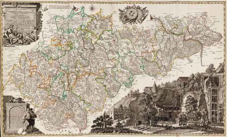
Carte von Ertzgebürgischen Creysse in Churfurstenthum Sachssen mit allen derinnen...
Pieter Schenk (*1655 - †1718)Reference 12589
Description
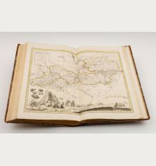
Monumental historical mining map of Saxony and the Erzgebirge by Pieter Schenk after Adam Friedrich Zürner. The large and detailed engraved map shows the Erzgebirge district with Dresden, Freiberg, Chemnitz, Zwickau, Reichenbach, Marienberg and Annaberg-Buchholz. To the upper left a beautiful title cartouche, to the lower right a large depiction of mining operations, to the left miners in traditional costume, at the top geographical instruments. Printed from two plates and joined.
The map is based on the manuscript map from Zürner's Atlas Augusteus Saxonicus which still exists in the original in the Saxon Main State Archives in Dresden. After Zürner's death in 1742, the maps were revised by his collaborator Paul Trenckmann and published by the Amsterdam publisher Pieter Schenk as Atlas Saxonicus novus from 1752. The map shown here comes from this atlas. From 1760 onwards, a reprint of this map with modified cartouches was produced by Lotter in Augsburg, still under Seutter's name.
Probably the most beautiful and impressive map of Saxony from this period.
Details
| Cartographer | Pieter Schenk |
| Title | Carte von Ertzgebürgischen Creysse in Churfurstenthum Sachssen mit allen derinnen befindlichen Aembtern und Herrschafften wie solche eingetheilet und zwart. |
| Publisher, Year | Pieter Schenk, Amsterdam, 1752-56 |
| Plate Size | 58.9 x 99.4 cm (23.2 x 39.1 inches) |
| Sheet Size | 61.5 x 101.3 cm (24.2 x 39.9 inches) |
Condition
Cartographer
Images to Download
If you like to download the image of this map with a resolution of 1200 pixels, please follow the link below.
You can use this image for publication on your personal or commercial websites for free if you set a link to this website. If you need photographs with a higher resolution, please contact us.
Saxony - Schenk, Pieter - Carte von Ertzgebürgischen Creysse in...

