Produkt wurde in den Korb gelegt
Sie haben 0 Artikel in Ihrem Warenkorb. Es gibt 1 Artikel in Ihrem Warenkorb.
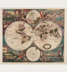
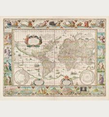
Novus Planiglobii Terrestris per Utrumque Polum Conspectus
Willem Janszoon Blaeu (*1571 - †1638)Artikel-Nr. 12554
Beschreibung
Die geheimnisvolle letzte Weltkarte von Blaeu.
Sehr schöne antike Weltkarte in Polarprojektion. 1672 von Joan Blaeu gestochen, jedoch wegen des großen Feuers im Verlagshaus von Blaeu niemals von ihm veröffentlicht. Die Kupferplatte gelangte in den Besitz von Gerald Valk, der sie ab 1695 gelegentlich in seinem Atlas verwendete.
R. Shirley beschreibt diese Blaeu/Valck Weltkarte in The Mapping of the World unter der Nummer 459 folgendermaßen:
Underneath Valck's imprint the erased signature of J. Blaeu can just be discerned, indicating that this plate was prepared in the last years of Joan Blaeu's life, in 1672-73. The projection used - two north and south polar views, each extending to the equator - is not a common one and it has been suggested that Blaeu intended this special map for the Spanish edition of the Atlas Maior which was never completed. No revisions to the map itself appear to have been made by Valck and the armorial shield map above the imprint cartouche remains blank. The title is at the top in a banner, against a backdrop of clouds, stars and the sun and the moon. At the bottom are two scenes: on the right Adam is happily seated in the Garden of Eden, and on the left a dismal post-lapserian Adam and Eve are in a wetter and rougher land. The map plate probably came into Valck's hands after an auction sale in 1694 by Wolfgang, the first purchaser of some of Blaeu's plates. The suggested re-issue date of c. 1695 anticipates the map's inclusion in the Schenk and Valck atlases of the early 1700s.
Für die damalige Zeit ist die doppelte Polarprojektion ungewöhnlich und erinnert an die Karten von Fine und de Jode. Durch die polare Projektion wird Nordamerika und Australien hervorgehoben. Die Großen Seen im Norden Amerikas sind noch ungenau eingezeichnet, Kalifornien ist als Insel mit flacher nördlicher Küstenlinie dargestellt. Australien hat eine erschlossene Westküste, die Ostküste ist jedoch nicht eingezeichnet.
Als eine der letzten kartographischen Produktionen des großen Blaeu-Verlages ist dies eine der interessantesten Weltkarten dieser Zeit und vergleichbar mit deren erster Atlas-Weltkarte in Mercator-Projektion.
Details
| Kartograph | Willem Janszoon Blaeu |
| Titel | Novus Planiglobii Terrestris per Utrumque Polum Conspectus |
| Verlag, Jahr | Amsterdam, 1672 [1695] |
| Bildgröße | 40.8 x 53.4 cm |
| Blattgröße | 53.6 x 62.6 cm |
| Referenz | Shirley, R. W.: The Mapping of the World, No. 459 |
Erhaltung
Kartograph
Bilder zum Herunterladen
Falls Sie die Bilder dieser Karte in einer Auflösung von 1200 Pixeln herunterladen möchten, folgen Sie bitte unten stehendem Verweis.
Sie können die Bilder auf Ihrer privaten oder kommerziellen Internetseite frei veröffentlichen, sofern Sie einen Verweis (Link) auf diese Webseite setzen. Falls Sie Fotos in höherer Auflösung benötigen, kontaktieren Sie uns bitte.
Weltkarten - Blaeu, Willem Janszoon - Novus Planiglobii Terrestris per Utrumque...

![Willem Janszoon Blaeu: Novus Planiglobii Terrestris per Utrumque Polum Conspectus Antike Landkarten, Blaeu, Weltkarte, 1672 [1695]: Novus Planiglobii Terrestris per Utrumque Polum Conspectus](https://www.vintage-maps.com/3523-large_default/blaeu-weltkarte-1672-1695.jpg)
![Ch'onha Chido [Atlas of all under Heaven] Ch'onha Chido [Atlas of all under Heaven]](https://www.vintage-maps.com/3336-home_default/anonymous-japan-korea-koreanischer-manuskript-atlas-chonha-chido.jpg)
![Ch'onha Chido [Atlas of all under Heaven] Ch'onha Chido [Atlas of all under Heaven]](https://www.vintage-maps.com/4291-home_default/anonymous-japan-korea-koreanischer-manuskript-atlas-chonha-chido.jpg)
