Produkt wurde in den Korb gelegt
Sie haben 0 Artikel in Ihrem Warenkorb. Es gibt 1 Artikel in Ihrem Warenkorb.
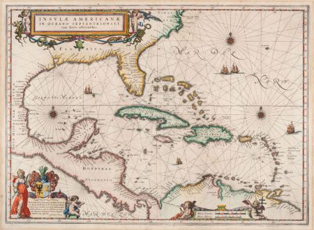
Insulae Americanae in Oceano Septentrionali, cum Terris adiacentibus
Willem Janszoon Blaeu (*1571 - †1638)Artikel-Nr. 11919
Beschreibung
Blaeus faszinierende Seekarte der Karibik
Handkolorierte, antike Seekarte der Karibik von Willem Blaeu. Erstmals im Theatrum Orbis Terrarum von 1634 veröffentlicht. Dieses Exemplar stammt aus der lateinischen Ausgabe von 1640. Die Karte blieb für die verschiedenen Ausgaben unverändert, nur der rückseitige Text hat sich geändert. Mit drei figürlichen Kartuschen, Segelschiffen und Kompassrosen verziert.
Philip D. Burden in The Mapping of North America zu diese Karte:
Cartographically the map draws on the extremely rare chart by Hessel Gerritsz, c.1631. The area of coverage is exactly the same with the exception of Blaeu's addition of the west coast of Central America. The nomenclature of the North American part is virtually identical, the only notable addition being the naming of VIRGINIA. It reflects the firsthand knowledge of Gerritsz during his voyage to South America and the West Indies undertaken in 1628. The distance between Chesapeake Bay and Albemarle Sound is accurately portrayed at 1°; even in Gerritsz's acclaimed NOVA ANGLIA ..., for de Laet, 1630, this distance is over 2°. It seems likely that a Spanish chart was used as the nomenclature along the south-east coast lacks any of the French influences often seen at the time.
Details
| Kartograph | Willem Janszoon Blaeu |
| Titel | Insulae Americanae in Oceano Septentrionali, cum Terris adiacentibus |
| Verlag, Jahr | Willem & Joan Blaeu, Amsterdam, 1640-43 |
| Bildgröße | 38.1 x 52.4 cm |
| Blattgröße | 47.7 x 56.5 cm |
| Referenz | Burden, P.D.: The Mapping of North America No. 242; Van der Krogt, P.: Koeman's Atlantes Neerlandici, 9600:2B |
Erhaltung
Kartograph
Bilder zum Herunterladen
Falls Sie die Bilder dieser Karte in einer Auflösung von 1200 Pixeln herunterladen möchten, folgen Sie bitte unten stehendem Verweis.
Sie können die Bilder auf Ihrer privaten oder kommerziellen Internetseite frei veröffentlichen, sofern Sie einen Verweis (Link) auf diese Webseite setzen. Falls Sie Fotos in höherer Auflösung benötigen, kontaktieren Sie uns bitte.
Mittelamerika - Karibik - Blaeu, Willem Janszoon - Insulae Americanae in Oceano...

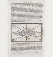
![[West Indies, Jamaica, Hispaniola and South America] [West Indies, Jamaica, Hispaniola and South America]](https://www.vintage-maps.com/3035-home_default/bordone-mittelamerika-karibik-guadeloupe-martinique.jpg)
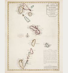
![[Lesser Antilles, West Indies] Guadalupe, Dominica, Matinina [Lesser Antilles, West Indies] Guadalupe, Dominica, Matinina](https://www.vintage-maps.com/3027-home_default/bordone-mittelamerika-karibik-guadeloupe-martinique.jpg)
