Product successfully added to your shopping cart
There are 0 items in your cart. There is 1 item in your cart.
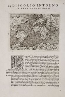
Discorso Intorno alla Carta da Navigare
Tomaso Porcacchi (*1530 - †1585)Reference 12361
Description
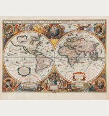
First edition of the nautical chart of the world by T. Porcacchi. This finely-executed map shows a large part of the world, but in the east it only extends just beyond India. In the south a large land mass labled Terra Incognita is shown. Very skillfully engraved by Girolamo Porro.
From the rare first edition of the famous L'Isole piu famose del Mondo the Isolario or Book of Islands by the Italian humanist and scholar Tomaso Porcacchi. Published 1572 in Venezia in a collaboration with the bookseller Simone Galignani and the Paduan engraver Girolamo Porro. A second edition followed in 1576, and further editions posthumously in 1590, 1604, 1605, 1620, 1686 and 1713.
Details
| Cartographer | Tomaso Porcacchi |
| Title | Discorso Intorno alla Carta da Navigare |
| Publisher, Year | Simon Galignani, Girolamo Porro, Venice, 1572 |
| Plate Size | 10.5 x 14.2 cm (4.1 x 5.6 inches) |
| Sheet Size | 29.5 x 20.0 cm (11.6 x 7.9 inches) |
| Reference | Shirley, R. W.: The Mapping of the World, No. 128 |
Condition
Cartographer
Images to Download
If you like to download the image of this map with a resolution of 1200 pixels, please follow the link below.
You can use this image for publication on your personal or commercial websites for free if you set a link to this website. If you need photographs with a higher resolution, please contact us.
World Maps - Porcacchi, Tomaso - Discorso Intorno alla Carta da Navigare

![Ch'onha Chido [Atlas of all under Heaven] Ch'onha Chido [Atlas of all under Heaven]](https://www.vintage-maps.com/3336-home_default/anonymous-korean-manuscript-atlas-chonha-chido-1820.jpg)
![Ch'onha Chido [Atlas of all under Heaven] Ch'onha Chido [Atlas of all under Heaven]](https://www.vintage-maps.com/4291-home_default/anonymous-korean-manuscript-atlas-chonha-chido-1800.jpg)
