Product successfully added to your shopping cart
There are 0 items in your cart. There is 1 item in your cart.
[Scandinavia]
Olaus Magnus (*1490 - †1557)Reference 12744
Description
Olaus Magnus' Important Map of Scandinavia.
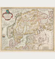
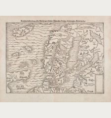
Very rare and important map of Scandinavia by Olaus Magnus, printed in 1567. From the Historia Olai Magni gothi archiepiscopi Upsalensis De gentium septentrionalium, published by Heinrich Petri in Basel.
The famous map is based on Olaus Magnus' great map of Scandinavia, printed from 9 woodblocks in Venice in 1539. Unfortunately, only 2 of the original maps survived, today in the Bavarian State Library and the Uppsala University Library. The Roman engraver Antonio Lafreri published a reduced version in 1572. The Historia de gentibus septentrionalibus (History of the Northern Nations) by Olaus Magnus, first printed in 1555, was accompanied by a reduced, one-sheet woodcut map. The larger double-sheet map of Scandinavia shown here only appeared in the Basel edition of 1567 and is very rare to find.
W.B. Ginsburg in The Mapping of the Northern Regions 1482-1601:
The 1567 Olaus Magnus possesses a certain visual appeal. Its angled upper corners are vaguely reminiscent of the 1539 prototype... Uncommon...
The large woodcut map of 1539 was the first large-scale regional map of Europe. It contained countless sea monsters, which inspired the cartographers Sebastian Münster and Abraham Ortelius to use these sea monsters to decorate their own maps. The variant here is inscribed at the lower right with the initials of the woodcutter Thomas Weber THW and the year 1567.
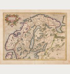
The map shows Iceland in the northwest, the north of Scotland in the southwest, Scandinavia with Norway, Sweden, Denmark and Finland, the Baltic States and parts of Russia in the east. In the northern Atlantic and North Sea, several sailing ships, sea monsters, a sea serpent and a sea monster attacking a ship.
Details
| Cartographer | Olaus Magnus |
| Title | [Scandinavia] |
| Publisher, Year | Henric Petri, Basle, 1567 |
| Plate Size | 36.0 x 51.7 cm (14.2 x 20.4 inches) |
| Sheet Size | 37.5 x 52.6 cm (14.8 x 20.7 inches) |
| Reference | Ginsberg, W.B.: Septentrionalium Regionum - The Mapping of the Northern Regions 1482-1601, No. 23 |
Condition
Cartographer
Olaus Magnus was a Swedish geographer and cartographer, Catholic clergyman and Bishop of Uppsala. He studied in Rostock and Cologne, was a canon in Uppsala and Linköping and went into exile in 1524 in the aftermath of the Reformation together with his brother Johannes Magnus, the exiled Archbishop of Uppsala. As a great zealot for the Catholic faith and opponent of Lutheran doctrine, he also took part in book burnings in Bologna.
Magnus achieved fame up to the present day with his main work, the Carta marina, a large-format map of Northern Europe. The monumental woodcut map, printed from 9 blocks, was produced in twelve years of work from 1527 to 1539 and is considered the earliest accurate map of Northern Europe. It was first printed in Venice in 1539. Today, only two examples of it have survived.
Images to Download
If you like to download the image of this map with a resolution of 1200 pixels, please follow the link below.
You can use this image for publication on your personal or commercial websites for free if you set a link to this website. If you need photographs with a higher resolution, please contact us.

![Olaus Magnus: [Scandinavia] Antique Maps, Magnus, Scandinavia, 1567: [Scandinavia]](https://www.vintage-maps.com/4072-large_default/magnus-scandinavia-1567.jpg)
